
Tuesday, June 20, 2006

NOAA Teacher At Sea: Jacob Tanenbaum
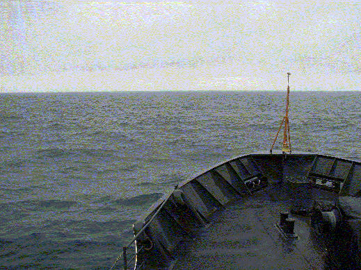
NOAA Ship MILLER FREEMAN
Mission: Bering Sea Fisheries Research
Day 20: June 20, 2006
Ship Status: At Port
Personal Log
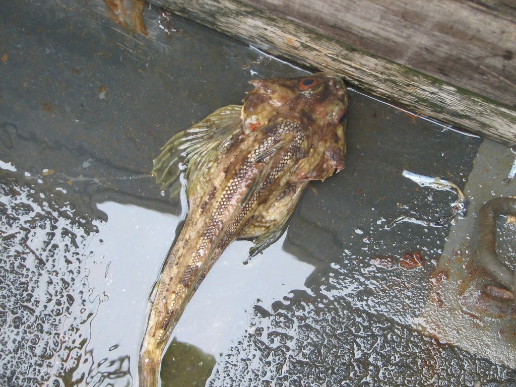
Click here if you would like to look at the results from the Pollock Study.
This will be my last blog entry for the trip. As the project draws to a close, I would like to evaluate how effective it was. There is a link to an electronic survey. I would like to ask students, teachers, parents, and other visitors to the site to take a few moments to let me know what you think of this idea. The survey is all electronic and only takes a minute or two to complete. Thank you in advance for your time. Click here to access the survey.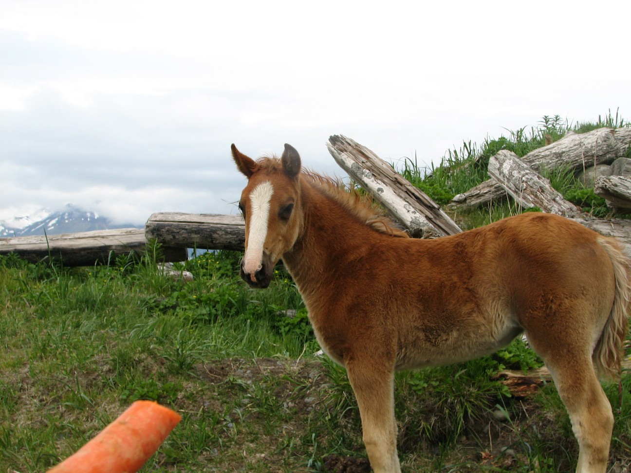 Today we arrived in the port of Dutch Harbor, Alaska early this morning. Dutch Harbor is a fishing village full of interesting sites to see and people to meet. It is also where the fishing vessels featured in the TV show “Deadliest Catch” are based, so a lot of you may have heard of it.
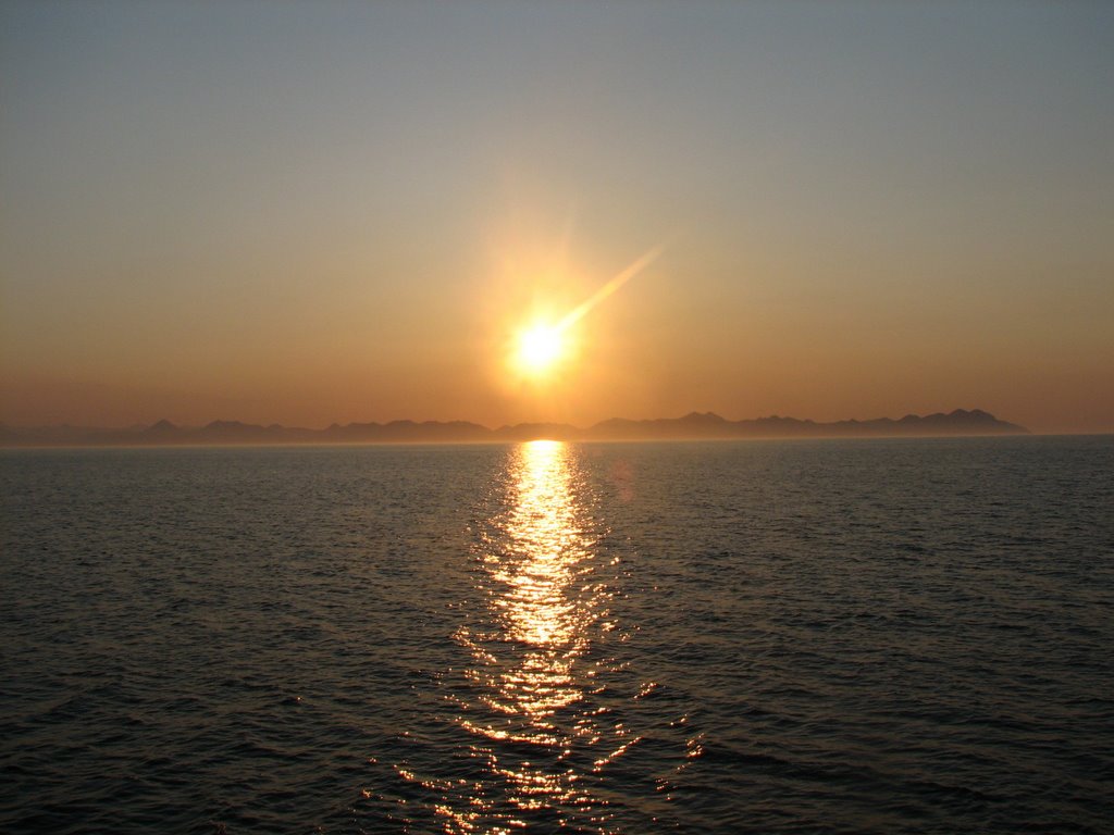
The highlights of an incredible day were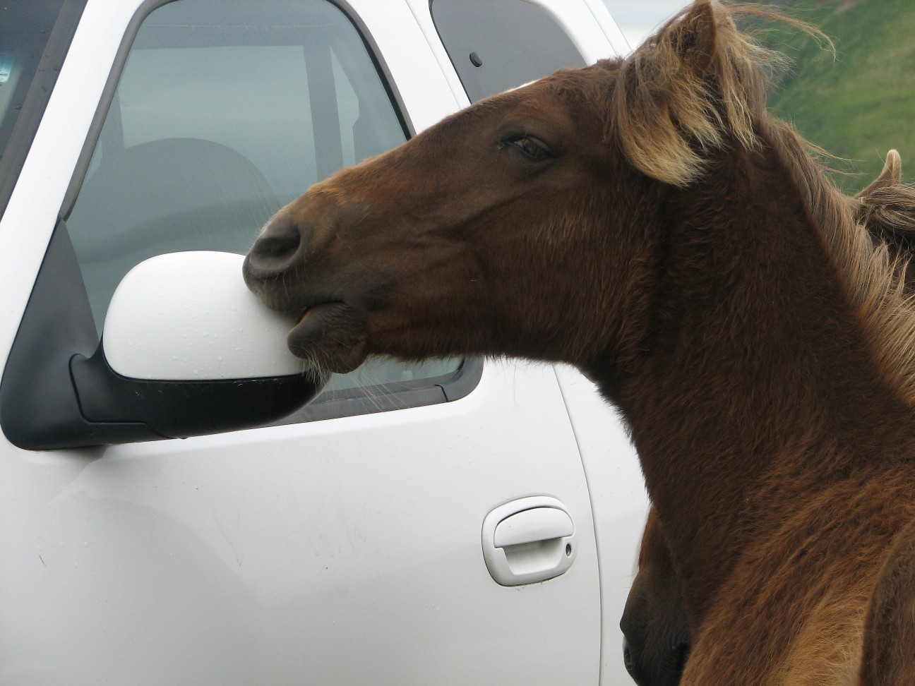
A herd of wild horses. Their ancestors were released here by US soldiers stationed here after World War 2. We couldn't figure out what they ate until... :)
More eagles than I have ever seen (click here for a video).
Climbing in mountains full of wildflowers.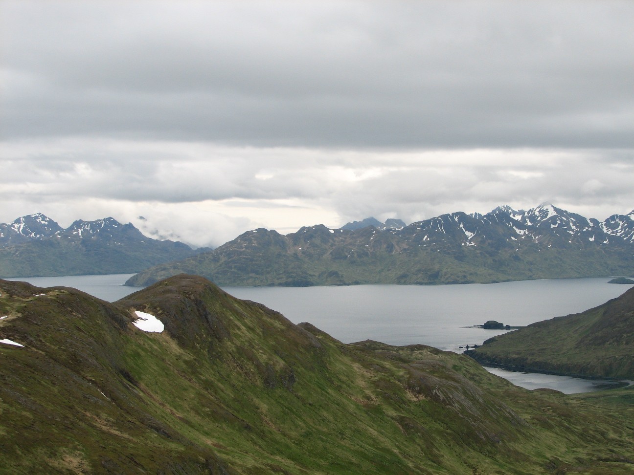
Snow!!
An incredible end to an incredible journey. Thanks all of you for sharing it with me.
Final Thoughts:
I would like to express my profound appreciation to everyone on board NOAA Ship MILLER FREEMAN. Every single person on board the ship welcomed me and helped me in every possible way with this project. The scientists and ships personnel answered every one of mine and your thousands of questions and opened the entire ship up to us all. Many of the people on board shared the blog with their families back home, and the notes I have gotten back from them touched me deeply.
To Commander Gallagher, Lieutenant Commander Boland, Dr. Paul Walline and the everyone on board, thank you for making this project possible and for all you have done to welcome me on board the ship these past weeks.
Thank you as well to the Jennifer Hammond, Elizabeth McMahon and everyone at the Teacher At Sea program for creating this wonderful opportunity and for all of your support before and during the project.
Thank you as well to all of you back home for taking part in this experiment. Teaching and learning with you from the Bering Sea has been one of the most rewarding experiences of my 19 years as an educator.
Have a great summer vacation everyone.
Monday, June 19, 2006
NOAA Ship MILLER FREEMAN
Mission: Bering Sea Fisheries Research
Day 19: June 19, 2006
Weather Data from the Bridge:
Visibility: Less than 1 mile
Wind Speed: 14 miles per hour
Sea Wave Height: 2 feet
Water Temperature: 44.06 degrees
Air Temperature: 41.36 degrees
Pressure: 1018 Millibars
Personal Log
NOTE: We will arrive in the port of Dutch Harbor, Alaska on June 20. As the project draws to a close, I would like to evaluate how effective it was. There is a link to an electronic survey. I would like to ask students, teachers, parents, and other visitors to the site to take a few moments to let me know what you think of this idea. The survey is all electronic and only takes a minute or two to complete. Thank you in advance for your time. Click here to access the survey. I should be able to send one more blog tomorrow from Dutch Harbor. Check back and I will let you know what being on land again feels like. Dutch Harbor should be an interesting place.
We passed the Pribilof Islands. Home to one of the largest worlds largest gatherings of marine mammals in the summer time. I got up to see the islands at midnight and again when we passed a second one at 4:00 AM. We were covered in fog both times, so we will have to come back another day. At midnight, the sun had not yet set. Our sun set last night at about 12:15 and it took a long time to grow dark after that. The sky began to grow light at about 5:00 and it came up a little after 6. A short night.
Science Log
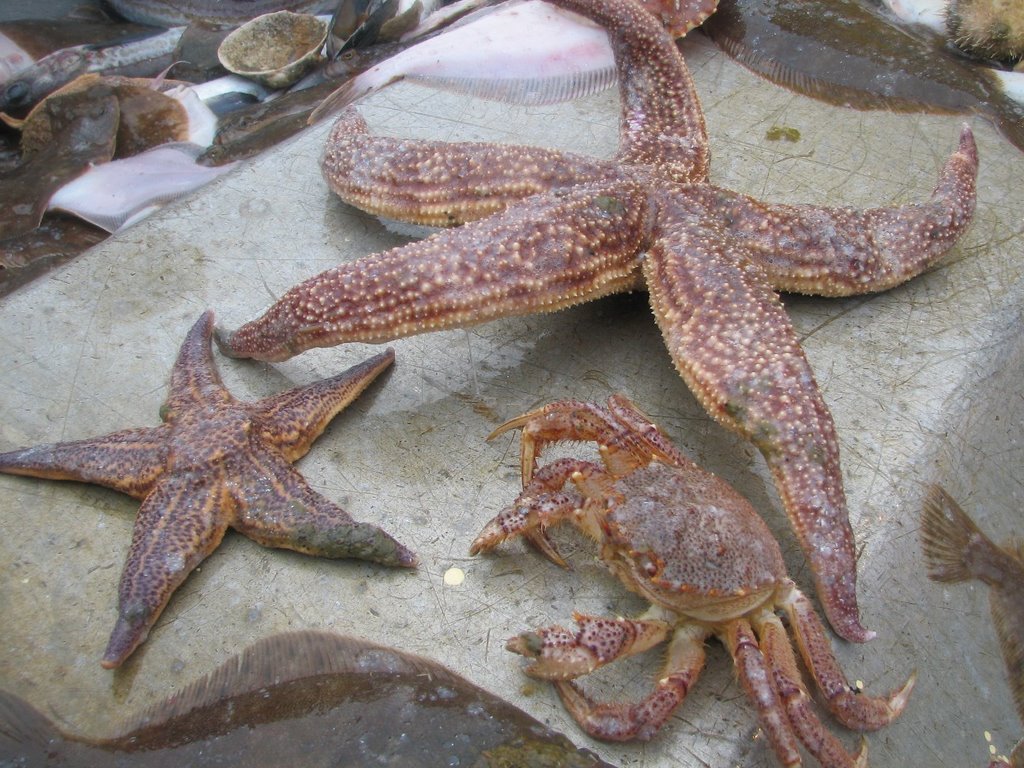
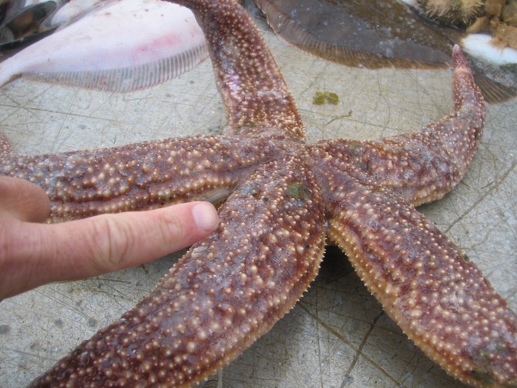
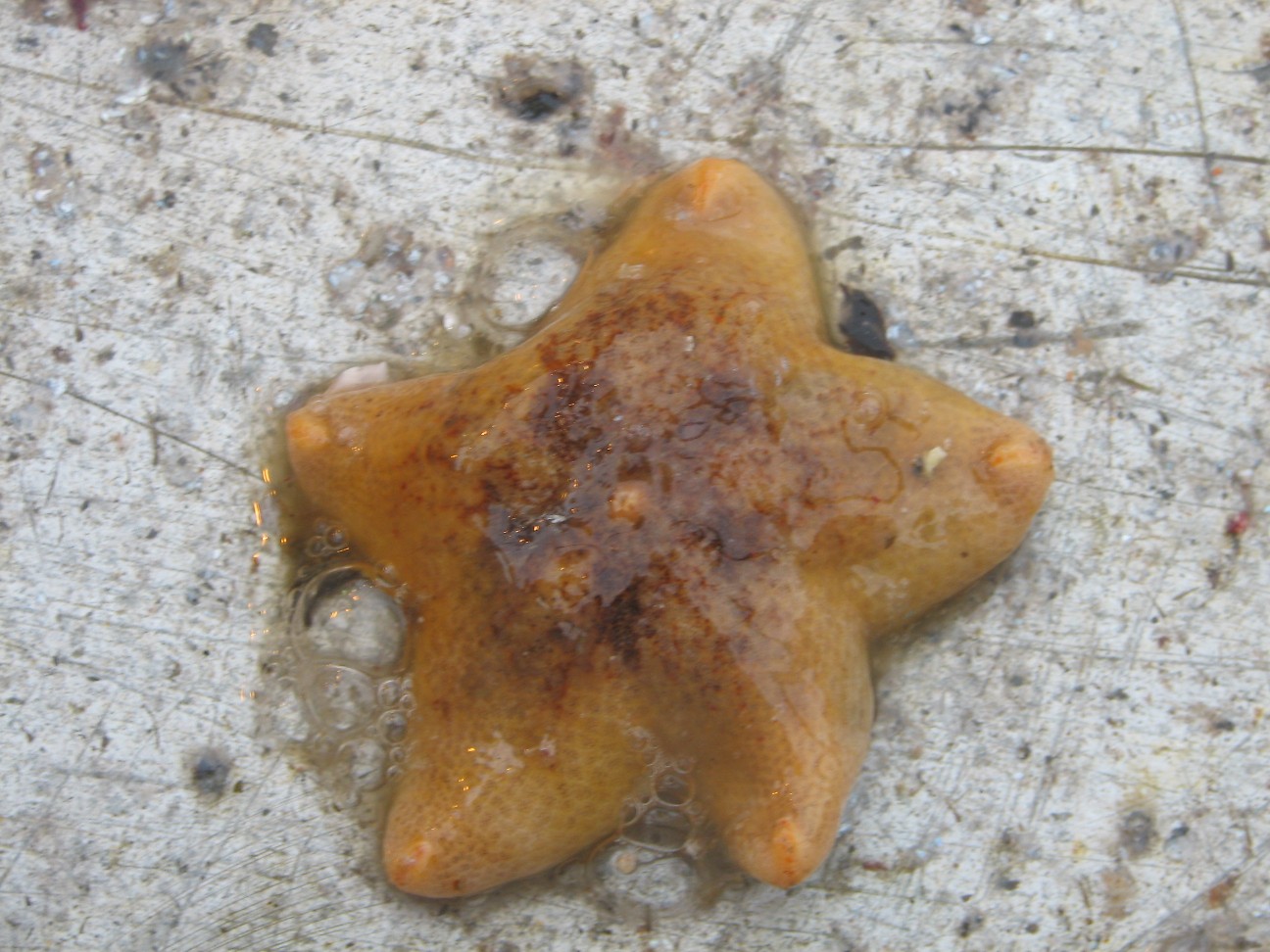
Last night we had another bottom trawl. This one had some of the largest sea stars I have ever seen. One was close to a foot long. Take a look.
In addition, there is a coral here called sea raspberry. It is common along the Bering Sea Shelf. I thought coral was only in tropical seas, but here it is in the Bering Sea.

Since it is our last day at sea, I spoke to our Chief Scientist Dr. Paul Walline from the Alaska Fisheries Science Center in Seattle Washington about what we have learned so far.
What does the data tell you so far?
What do you expect to see in the next legs?
What will happen to the data at the end of the cruise?
Finally, we were testing a platform today that can open nets at different depths. We lowered the
 platform to about 390 feet before a technical problem forced us to raise it back up to the surface. As an experiment of my own, I tied a bag of Styrofoam cups to the platform to see what the pressure at that depth would do to them. Want to see more? Click here for a video
Question of the Day:
What was your favorite part about participating in this project. Please write and let me know.
Photos
Saint Paul Island in the Pribilof Islands seen through the fog
Sea stars and crabs from a bottom trawl
Sea star from a bottom trawl
Red Raspberry Coral
Sunday, June 18, 2006
NOAA Ship MILLER FREEMAN
Mission: Bering Sea Fisheries Research
Day 18: June 18, 2006
Weather Data from the Bridge:
Visibility: 10 miles
Wind Speed: 9 miles per hour
Sea Wave Height:2 feet
Water Temperature:41 degrees
Air Temperature:40.8 degrees
Pressure: 1013 Millibars
Personal Log
NOTE: We will arrive in the port of Dutch Harbor, Alaska on June 20. As the project draws to a close, I would like to evaluate how effective it was. There is a link to an electronic survey. I would like to ask students, teachers, parents, and other visitors to the site to take a few moments to let me know what you think of this idea. The survey is all electronic and only takes a minute or two to complete. Thank you in advance for your time. Click here to access the survey.
By now, you have met many of the interesting people aboard NOAA ship MILLER FREEMAN. There are three groups of people aboard these ships. The officers on the ship are part of the NOAA Corps. This is a uniformed service of the United States consisting of about 300 officers who complete rigorous training and hold ranks, like ensign, or commander. They are in charge of ships operations and stand watch on the bridge.
The scientists aboard are mostly from NOAA research labs, like the Alaska Fisheries Science Center in Seattle.
Many of the other members of the crew are civilian wage mariners. These are professional
 sailors who handle many of the day to day operations of the ship. Some, such as Chief Engineer Bus, have made their home on this ship for close to 30 years. Other sailors are contract workers who come aboard for a few months, go home and take a break, then join the crew of another ship for a different sort of cruise. Sometimes they are on research vessels, sometimes they are on freighters, sometimes they are on tankers. Today, lets meet able-bodied seaman, or AB Michael O’Neal. Click each question to listen to the answer.
What do you do on board the NOAA Ship MILLER FREEMAN?
Tell us about what you have done and where you have gone on some of the other ships you have been on.
Where are some of the other jobs you have had at sea?
What does it take to be an able-bodied seaman?
Science Log:
We had another in a series of amazing bottom trawls last night. When the nets trawl along the bottom out here, some of the most interesting creatures of all get swept into our nets. Creatures that live on the bottom are often stranger looking for a few reasons. They are adapted to blend into the bottom so that predators cannot see them. They often wind up looking like rocks or plants as a kind of defense. They are also adapted to an environment with higher pressure and less light than the surface. Some of their adaptations can also make them look very different from other fish. Since they don’t have to worry about predators below them, these fish may be flat and have both their eyes sticking up. These creatures often do not need to be fast swimmers, since their defense is to blend into the environment rather than swim away when predators approach.
This basket of sea cucumbers was one of the strangest things I’ve seen so far. These sticky blobs are not plants. They are sea creatures that live on the bottom of the sea and sift through the sand or water to find food. There are several different kinds of sea cucumbers in this basket. Can you see the different types?
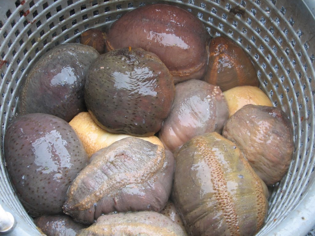
Here is a different kind of sea star than the ones we have found so far. It is called a mud star. It is soft and sticky, not like the sea stars we have at home. It may be called a mud star, but I think looks like Patrick from Sponge Bob.
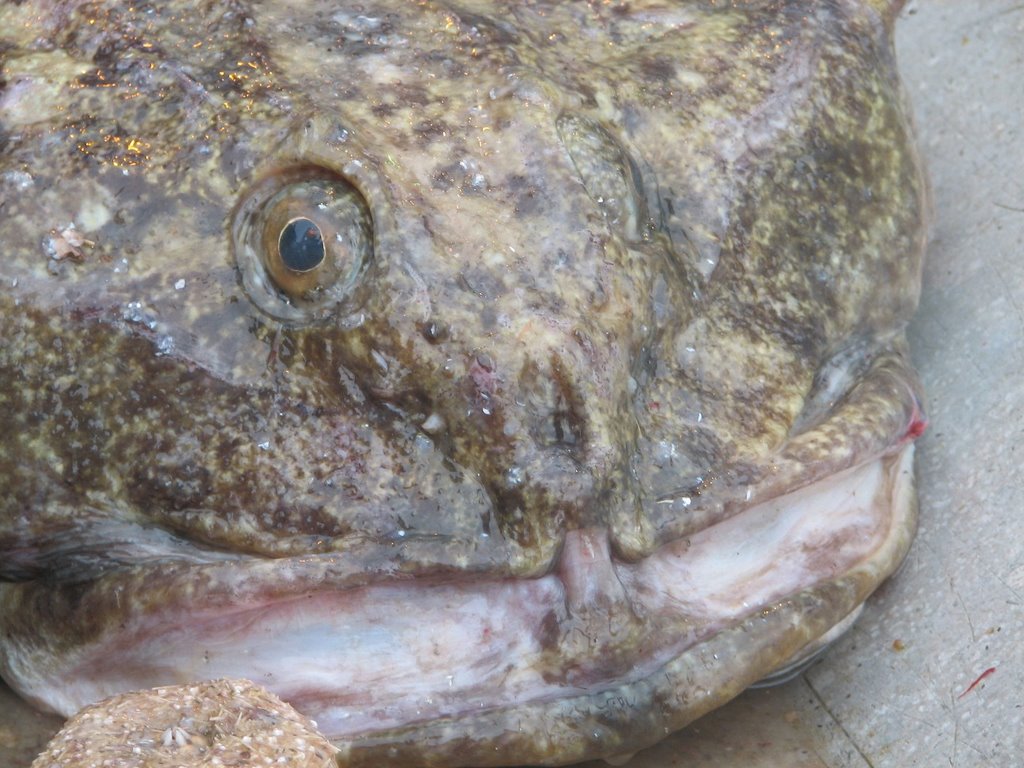
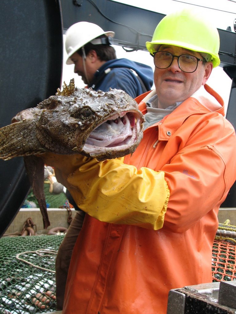
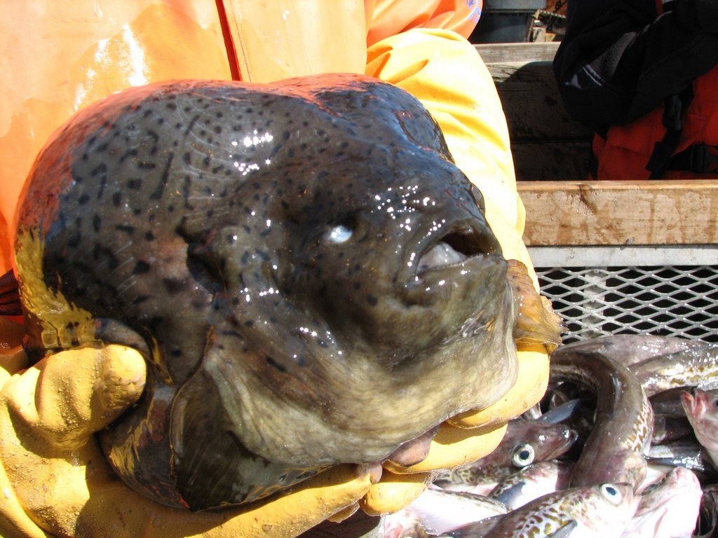
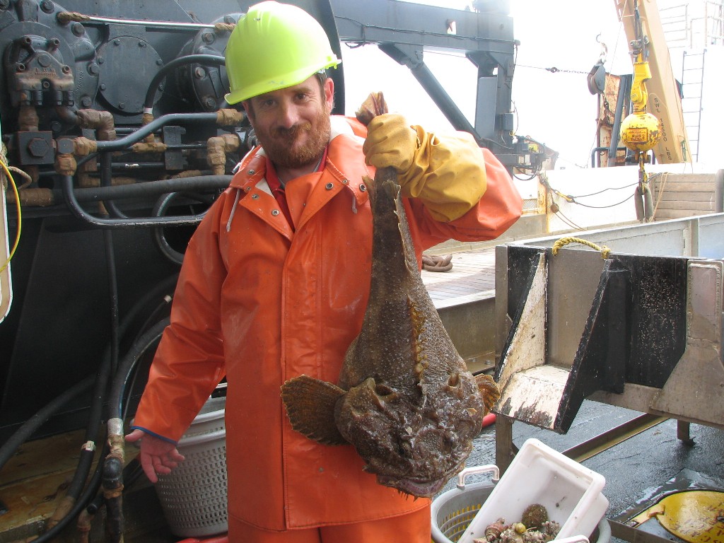
Smile! Here are two photos of big mouth sculpins. Once close up and one in the hands of Dr. Mikhail Stepanenko.
Here is another kind of sculpin with large fins that look like the wings of a butterfly. It is called a Butterfly sculpin.
Question of the Day
Now that you have seen some of the different jobs aboard NOAA Ship MILLER FREEMAN, if you were on a ship, which job would you prefer? Write me a comment on the blog and let me know!
Answer to Yesterday’s Question
Look at the movements of the ship described above. When the ship drives into the wind and waves, sailors call it a corkscrew motion. Can you think why?
A corkscrew motion occurs when the ship is struck by waves in such a way that it moves in several motions at once. In other words, it may pitch, roll, surge, and sway all at the same time. I’m getting a funny feeling in my stomach just thinking about it!
Answers to Your Questions
Sorry that I left off the link from Friday where you can see the position of the ship. Here it is. Fair warning, the site was down for most of today, so if it does not work, just try again later.
http://info.nmao.noaa.gov/shiptracker/Ship.aspx?ship=Miller%20Freeman
After we put in to port, I’ll have a day or two in Dutch Harbor to look around, before I can get a flight in to Anchorage. After that, I’ll be visiting some friends and family out west before I head back east. Thanks for writing.
Photos:
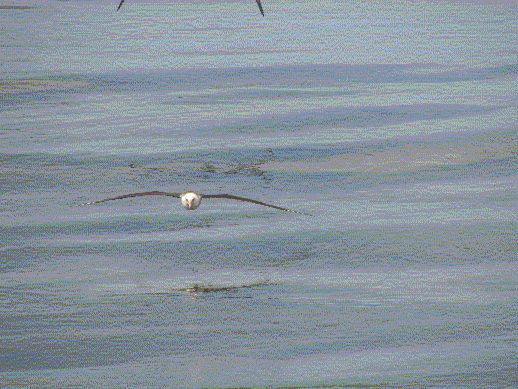
An albatross lands in the water behind the ship
AB Michael O’Neal
Photos from a bottom trawl as noted in the blog
Saturday, June 17, 2006
NOAA Teacher At Sea: Jacob Tanenbaum
NOAA Ship MILLER FREEMAN
Mission: Bering Sea Fisheries Research
Day 17: June 17, 2006
Weather Data from the Bridge:
Visibility: 14 miles
Wind Speed: 25 miles per hour
Sea Wave Height 7: feet
Water Temperature: 44.06 degrees
Air Temperature: 44.96 degrees
Pressure: 1009 Millibars
Personal Log
NOTE: We will arrive in the port of Dutch Harbor, Alaska on June 20. As the project draws to a close, I would like to evaluate how effective it was. There is a link to an electronic survey. I would like to ask students, teachers, parents, and other visitors to the site to take a few moments to let me know what you think of this idea. The survey is all electronic and only takes a minute or two to complete. Thank you in advance for your time. Click here to access the survey.
Well, we had pea soup for lunch today, also called storm soup by sailors. Legend is that when you serve pea soup, the weather will turn stormy, and sure enough, a gale is blowing nearby and the waves are picking up. The soup was great, though. As the ship rocks and rolls to the rhythm of the waves, lets take a closer look at how it moves. Sailors have lots of different terms for ships movement:
Pitch – refers to the up and down movement of the front, and back, or bow and stern of the ship
 .
.Yaw -- when the ship spins from side to side.

Heave -- When the entire ship moves up and down.

Roll --- When the ship rocks from side to side.
Surge – When the ship jumps forward or backward.
Sway – When the ship jumps sideways.
Happy Father’s Day to all. A special hello to my own father, Elias, and my two son’s Nicky and Simon. I miss you, guys.
Science Log
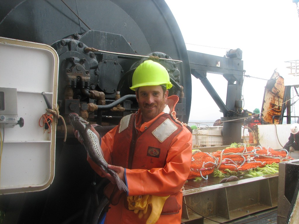
Our trawl nets picked up the smooth lumpsucker fish near the bottom last night.
 This fish tends to say near the bottom and can inflate itself with water as a defense against predators. A good defense, I would say. Would you want to eat it?
Our survey continues. We brought in two hauls of fish this morning. Tamara is having less time on the bridge looking for birds in the last day or so. Her time is limited because we are fishing more and a large group of birds following a fishing net is not considered a natural occurrence, so she does not count them in her study. If the waves are too high, she cannot see the small birds in the troughs of the waves, so she can’t count during heavy seas, and right now, the seas are fairly heavy.
Question of the Day:
Look at the movements of the ship described above. When the ship drives into the wind and waves, sailors call it a corkscrew motion. Can you think why?
Answer to Yesterday’s Question
It is about 8:00 AM on Saturday morning. If the ship uses 2100 gallons of fuel a day, how many gallons of fuel will we need to get to Dutch Harbor on Tuesday Morning at about 8:00 AM?
It will take 3 days to reach Dutch Harbor. Since the ship uses 2100 gallons of fuel a day, we have to multiply 2100 x 3 which equals 6300 gallons of fuel. Enough for my car to drive 157500 miles. Wow.
Answers to Your Questions
Hello to James H from yesterday.
Thanks for writing
Photos
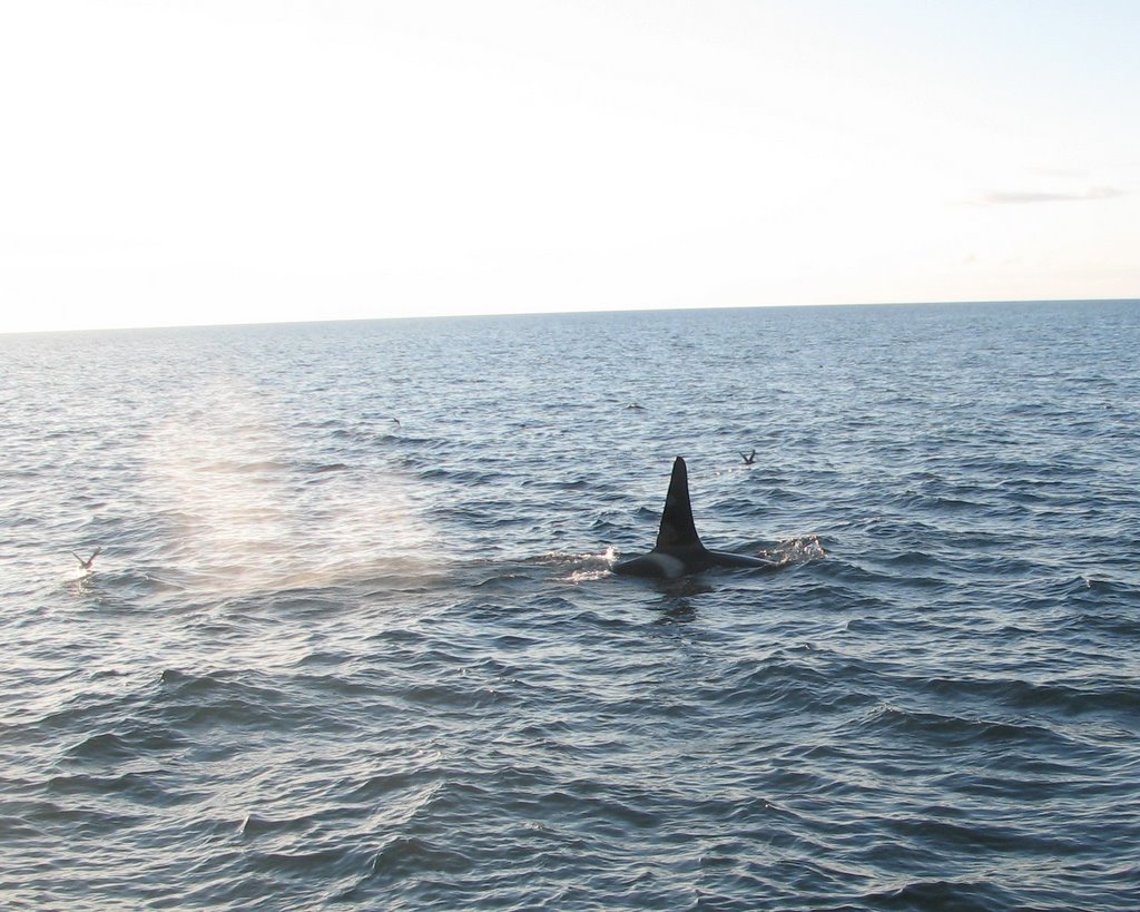
A “bow washer” wave
Smooth Lumpsucker fish.
Orcas from June 12th
Friday, June 16, 2006

NOAA Ship MILLER FREEMAN
Mission: Bering Sea Fisheries Research
Day 16: June 16, 2006
Weather Data from the Bridge:
Visibility: 14 miles
Wind Speed: 27 miles per hour
Sea Wave Height: 7 feet
Water Temperature: 41.7 degrees
Air Temperature: 42.4 degrees
Pressure: 1013.8 Millibars
Personal Log
NOTE: We will arrive in the port of Dutch Harbor, Alaska on June 20. As the project draws to a close, I would like to evaluate how effective it was. There is a link to an electronic survey. I would like to ask students, teachers, parents, and other visitors to the site to take a few moments to let me know what you think of this idea. The survey is all electronic and only takes a minute or two to complete. Thank you in advance for your time. Click here to access the survey.
How do you find your way around when you can’t see any land? I spent some time with Ensign
 Lindsey Vandenberg, on NOAA Ship MILLER FREEMAN.
Every 30 minutes or so, the bridge officers take a “fix” on their position. How do they do it? When they are out at sea, they take the latitude and longitude from the GPS and plot their exact position on a chart. A GPS is a machine that uses satellites to display the exact longitude and Latitude on a screen. The charts also have the latitude and longitudes written on them, but there is a problem. The longitude and latitudes scales on the chart are on the side and bottom of the chart, not where the ship is located. Every so often, there is a line across the entire chart. The navigator must use a tool, like the same compass you might use in math class, to mark the distance to the exact point on a scale from a line on the chart. She can then use the same tool to mark the distance in the part of the chart where we actually are. This must be done for both the longitude and latitude of the ship.
When we are near land, we can use Terrestrial Navigation. This means we can use the distance
 to an object on the shore, such as a lighthouse, to find out where
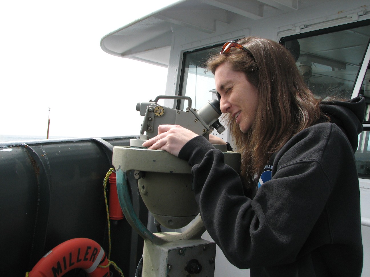
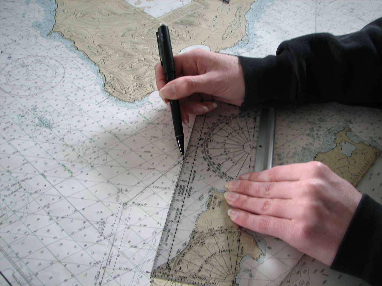 we are. With a large ship close to shore, it is very important that we know exactly where we are so that we don’t wind up in shallow water. Ensign Vandenberg uses a tool called an alidade to help her. She puts the alidade over a large compass outside of the ship. The instrument reflects the compass into the viewer so she can see both the object on shore and the exact compass heading. If she takes a few bearings to objects on shore, she can use tools to chart her exact position on the chart.
Science Log:
I’ve been asking many of the people on the ship what becomes of the data that we are collecting. This survey will be used to set quotas for one of the most important fisheries in the world. Here is how it works. If too many fish are caught in an area, there will not be enough fish left for the species to come back the next year. That is bad for the fish, and bad for the fisherman. To prevent this “overfishing,”. A quota, or limit to the number of fish that can be safely caught, is established. Methods are put in place to make sure that all fishing boats in the area respect the quotas. Do you want to learn more? Take a look at this short video on the subject.
Question of the Day:
It is about 8:00 AM on Saturday morning. If the ship uses 2100 gallons of fuel a day, how many gallons of fuel will we need to get to Dutch Harbor on Tuesday Morning at about 8:00 AM?
Answers to Yesterday’s Question:
If our ship wants to do a trawl 50 meters below the surface, how much wire would it need.
The ship must put out two feet of wire for every one foot of depth. So you have to multiply 50 x 2 which gives 100 meters of wire. Each net has, not one, but three wires holding it to the ship. So you would need 3 wires. All three are 100 meters in length. That gives us 300 meters of wire to do our trawl.
Answers to Your Questions:
Hello to all who wrote today.
Colin, no seawater on the equipment yet. They have a couple of computers in the lab where we process fish that can be drenched with water and will still work. Maybe I need one of those.
Mrs. Z. Click here to see the route we have taken so far. I do not think it will give you exact miles, but you can get a good idea of our total.
Thanks for writing.
Photos:
Waves washing over the bow of NOAA Ship MILLER FREEMAN
Ensign Lindsey Vandenberg, on NOAA Ship MILLER FREEMAN shows us how to navigate:
-- Plotting longitude and latitude (2 photos).
-- Taking a bearing with an alidade.
-- Ploting the bearing on a map.
Thursday, June 15, 2006
NOAA Ship MILLER FREEMAN
Mission: Bering Sea Fisheries Research
Day 15: June 15, 2006
Weather Data from the Bridge:
Visibility: 14 miles
Wind Speed:19.5 miles per hour
Sea Wave Height: 4 foot
Water Temperature: 44.4 degrees
Air Temperature: 44.2 degrees
Pressure: 1018.8 Millibars
Personal Log
I got to thinking the other day that the engines on this ship have been running since we left port almost two weeks ago now. I started to wonder how they could stay running for so long and so I decided to ask Chief Engineer Steve Bus to tell me more about them. So put on your ear protection, and lets go to the engine room.
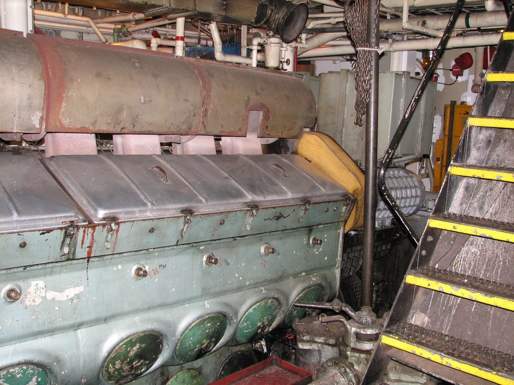 The engine room on NOAA Ship MILLER FREEMAN is like a
 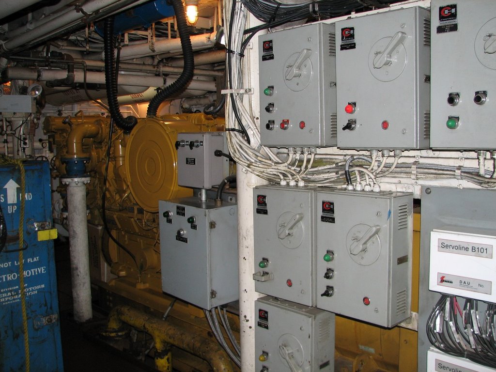 small city below the deck. In addition to the 2100 horsepower diesel engine that moves the ship forward, there are generators sufficient to power a small town. A research vessel, after all, needs a lot of electricity to run all the electronics we need. In addition, the engine room has equipment to make it’s own drinking water out of sea water. We cannot drink sea water because it has too much salt for our bodies to handle. The machines in the engine room take the salt out of the water and, clean it, and make it possible for us to drink it. There are boilers to heat water and make steam to keep the ship warm. There are also machines that process waste water. Finally, there is shaft alley. This is the part of the
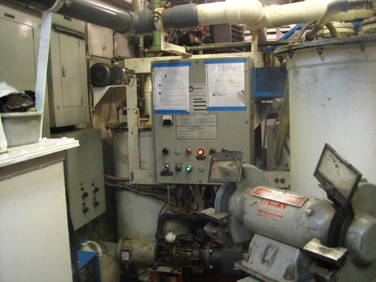 engine room where a long metal shaft connects the diesel engine to the propeller. Take a look at this video to see shaft alley.
The ship burns 2100 to 2200 gallons of fuel on an average day. Who keeps it all running? Chief Engineer Steve Bus and his crew. They are responsible for the ship from bow to stern.
How do you prepare for an emergency at sea? The same way you do in school. By drilling over and over. Today, we had a fire drill where the some of the crew got into firefighting gear and practiced what they would do in an actual emergency. Want to come along? Click here for a video.
Science Log
We had some interesting returns on the echosounder this morning. Take a look at the screen.
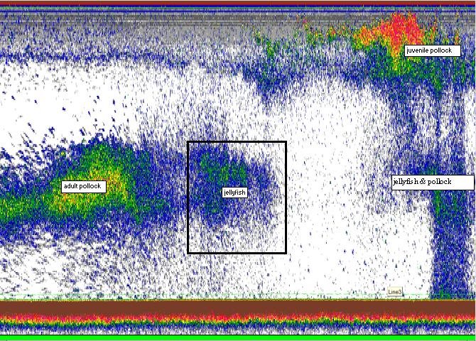 You can clearly see the top and bottom of the water column. You can clearly see the different groups of fish. The echosounders can tell us so much information. When we put the nets down near the surface, we knew exactly what to expect.
We did a trawl along the bottom of the sea floor last night and brought up some of the most interesting creatures I’ve ever seen. Here are a few.

This is a basket star, a kind of sea star. Its branches are hard and are divided into many different branches. The basket star uses all of these to catch plankton. In the center is the mouth.

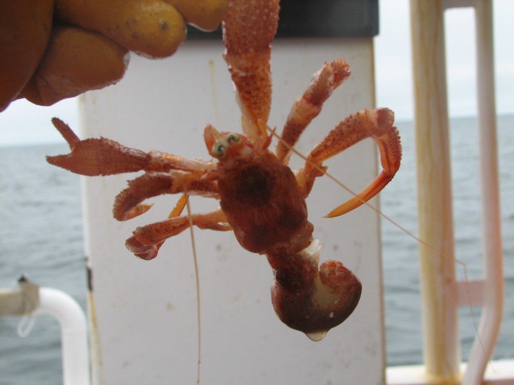
Next, we have a lyre crab.
Have you ever seen a hermit crab without a shell? This one lost his on the way up from the bottom.
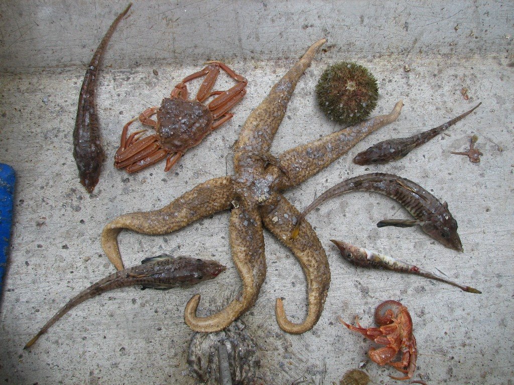
This next photo includes a huge sea star, a sea urchin, a hermit crab without its shell, a tanner crab and several fish called poachers. These fish have scales that are hard, almost like bone or a shell.
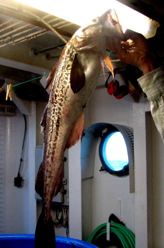
This last one is my personal favorite. The fish at the top of the screen is called a big mouthed sculpin. It has the biggest mouth of any fish I’ve ever seen. This fish stays on the bottom waiting for smaller fish to come by, and then… watch out! When it came up in the net, it had a smaller fish in its mouth.
Finally, we brought up a creature called a brittle star. It is a kind of sea star with soft tentacles. It moves very fast for a sea star. The arms can break easily, but don’t worry, they grow back. That’s why they call it a brittle star. Here is a video of a brittle star moving across the lab table.
Later on the same day, our ship was visited by some dall’s porpoises. Click here for a video
Question of the Day
Look at the answer to yesterday’s question. Let’s try another one. If our ship wants to do a trawl 50 meters below the surface, how much wire would it need.
Answer to Yesterday’s Question:
How much wire would the ship need to let out if it wanted to put the nets 200 feet below the surface? Make sure to watch the video on nets before you try to answer the question.
The ship must put out two feet of wire for every one foot of depth. So you have to multiply 200 x 2 which gives 400 feet of wire. Wait, we are not finished yet. Each net has, not one, but three wires holding it to the ship. So you would need 3 wires. All three are 400 feet in length. That gives us 1200 feet of wire to do our trawl.
Answers to Your Questions
Hello to all who wrote today.
The MILLER FREEMAN does seem like home to me now. I have gotten used to the constant rocking of the ship and the routines of the day. I really enjoy being at sea. By the way, they had pizza for lunch, but I asked the cook to make me some fresh pollock that we caught and filleted last night.
Do people eat jellyfish? I asked our chief cook, Mr. Van Dyke. He told me many species of jellyfish are poisonous. Even those that are safe to touch with your hands. So, no, we don’t’ eat them here, but in some countries they do. We have caught many tons of fish, but more importantly, we have seen many fish without catching them using our echosounder. This device allows us to survey fish without capturing so many.
There are 34 people on board with us for this cruise. That will change next week when we get to port.
The squid felt slimy, but not much more slimy than most fish seem. I don’t recall it spraying anything.
Thanks for writing..
Photos:
Various photos from the engine room in NOAA Ship MILLER FEEMAN
Main Engine
Generator
Water treatment equipment
Sewage treatment equipment
A basket star
Various fish from the bottom trawl we did last night
The echosounder return from last night
A lyer crab
A hermit crab
Big mouthed scaulpin
Wednesday, June 14, 2006
NOAA Ship MILLER FREEMAN
Mission: Bering Sea Fisheries Research
Day 14: June 14, 2006
Weather Data from the Bridge:
Visibility: 14 miles
Wind Speed:14 miles per hour
Sea Wave Height: 3 foot
Water Temperature: 5.3 degrees
Air Temperature: 6.2 degrees
Pressure: 1018 Millibars
Personal Log
A lot of you have been asking about the food on ship. How do we eat? What do we eat? Where do we get our food. All of these are great questions, so yesterday I spent some time with Chief Cook Russell Van Dyke to get some answers for you. He, along with the Chief Steward and the Second Cook, is responsible for preparing all the meals on NOAA Ship MILLER FREEMAN.
How do people eat on a ship? “With a knife and fork,” said our chief cook with a smile. Food is prepared and served on the ship in much the same way that you prepare and serve food at

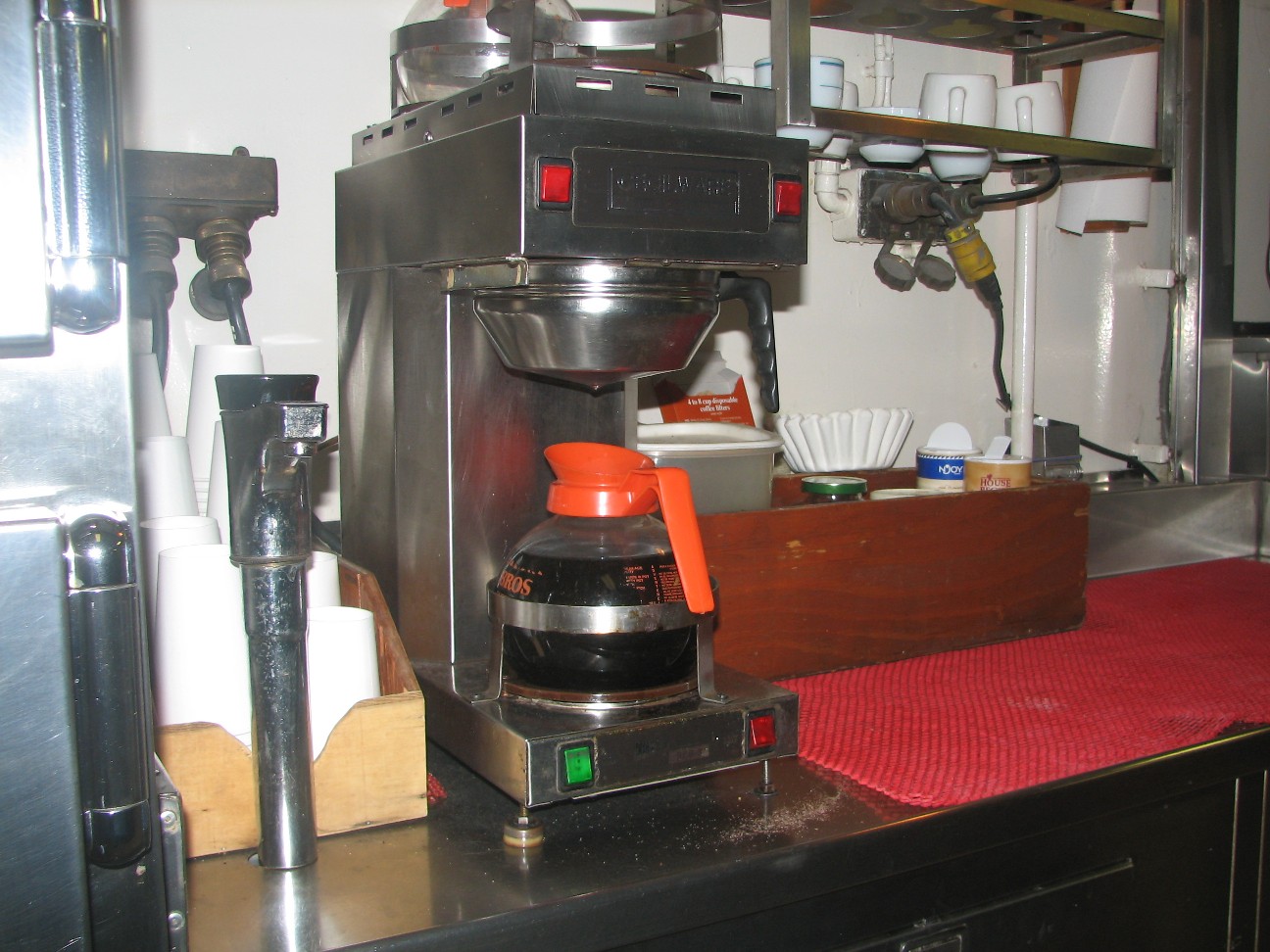 home. The main difference is quantity. Here on the ship, food is prepared for 40 people instead of just a few. “We don’t cook one, chicken, like you do at home,” said Mr. Van Dyke, “we cook 5 chickens. Here are some pictures of where the food is cooked, and where the food is served. On a ship, this is called the galley. Can you see the ring around the coffee pot? Can you guess what that is for? During storms at sea, when the waves are high, that ring keeps hot coffee from flying around the galley. Good idea!
Another interesting difference between food on a ship and food at home is that when you are out to see for a month, you cannot run down to the corner to get some milk if you run ou
 t. Each time
  NOAA Ship MILLER FREEMAN is in port, it must take on enough food to last for the entire journey to come. How do they keep all that food? Aside from being a great cook, Mr. Van Dyke and the rest of the crew are also experts in how to store food and keep it from going bad. NOAA Ship MILLER FREEMAN has not one but three refrigerators and two freezers. The refrigerators are kept at slightly different temperatures. The dairy products, like milk and cheese are kept at 37 degrees . The fruits and vegetables are kept in a separate refrigerator at 42 degrees. They keep the humidity in that refrigerator higher as well. Those slightly different conditions help keep the food fresh for a longer period. Meats and ice cream are kept frozen. Dry foods, like cereal are kept in a separate area. Put it all together and the crew on board eat great meals every day. The photo here shows the inside of one of the refrigerators.
Click below to listen to Chief Cook Russell Van Dyke describe cooking on board a ship:
Where does the ship get its food?
How do you cook on board a ship?
Does the crew have a favorite food?
One more question: Does the crew eat split pea soup? There is a superstition among mariners that cooking split pea soup will bring on a storm. I asked Mr. Van Dyke about it. He told me they eat it all the time. This brave crew last had “storm soup” on May 27th and we may have it again in a few days. I guess the only thing they can’t do on board this ship at sea is have a pizza delivered.
Science Log:
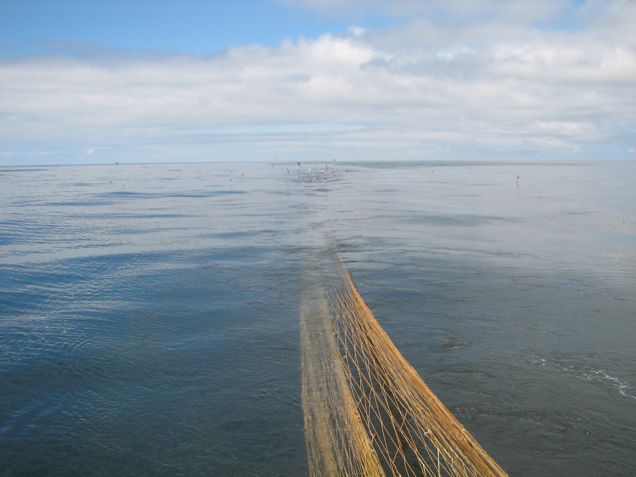
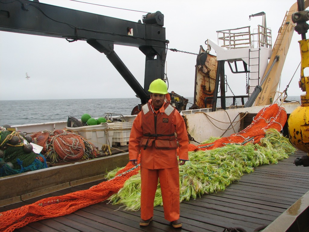
We continue surveying pollock and surveying birds as we move along the transact lines in the Bering Sea. Most of the surveying is being done with the echosounder, but from time to time, we put the nets into the water and trawl for fish. This helps the scientists know more detail about the fish they see on the echosounders. The nets on NOAA Ship MILLER FREEMAN work basically the same way that nets on large commercial trawlers work. We just catch far fewer fish. Would you like to learn more? Click here for a video on the nets.
Question of the Day:
How much wire would the ship need to let out if it wanted to put the nets 200 feet below the surface? Make sure to watch the video on nets before you try to answer the question.
Answer to Yesterday’s Question:
Look at the speed of the ship on this website: About how far would it go in 24 hours? To get your answer, you should multiply the speed you see by 24. Remember to express your answer in nautical m iles. At the moment, the ship is going about 12 nautical miles per hour. At that speed it will travel about 288 miles per day. The real figure will vary because of winds and currents that effect our speed, and because we sometimes stop to fish.
Answers to Your Questions:
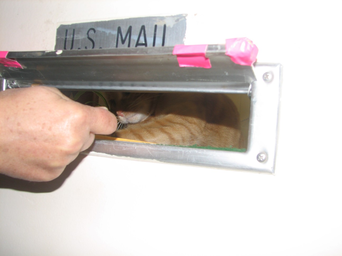
I also had an email request from Marcelo for photos with Rusty and I. Here is one. I
 ’m also putting a second photo on to show you one of Rusty’s favorite games. There is a mail slot in the door to the office where he spends a good part of his day. He loves to stick his paw through and introduce himself to passersby. Surprise!!
Mrs. McBride, thanks for your kind words.
To my Kindergarten friend, was the squid slimy? YES!!! :)
Photos:
Orca off the port beam.
The coffee pot. See the ring to keep the coffee from flying when the seas get rough?
Chief Cook Russell Van Dyke
The kitchen in NOAA Ship MILLER FREEMAN
The inside of one of the refrigerators. Look how big it is.
The Galley where the crew eat
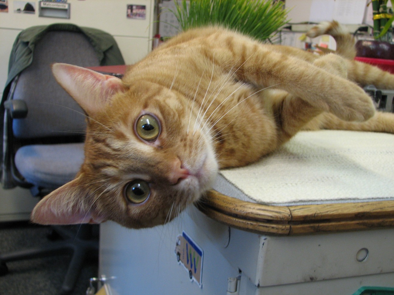
Rusty, the ships cat and Teacher at Sea Jacob Tanenbaum
Rusty gets the mail
Tuesday, June 13, 2006
NOAA Ship MILLER FREEMAN
Mission: Bering Sea Fisheries Research
Day 13: June 13, 2006
Weather Data from the Bridge:
Visibility: 14 miles
Wind Speed: 11.4 miles per hour
Sea Wave Height: 1 foot
Water Temperature: 44.2 degrees
Air Temperature: 44.2 degrees
Pressure: 1054.35 Millibars
Personal Log
Ever been to a place where it was too beautiful to sleep? It’s funny, but when you are on land, no matter how wonderful the view is, you always have the feeling that you can go to sleep, and it will still be there when you wake up. On a ship, that’s not true. A ship moves during the night and you will wake up somewhere else, so if you find a beautiful spot, you had better see it while you can. So far, there have been two nights when I did not get to sleep much simply because the spot we were in was just too beautiful.
Last night, we were moving along the Aleutian Islands near an island called Unalaska (click here to see it on Google Earth) and the view was spectacular. Let me show you a few photos and videos of the incredible wildlife and the spectacular sunrise and sunset (and if you see them both in Alaska in the summer, you know you did not get much sleep). Click on each photo to enlarge!
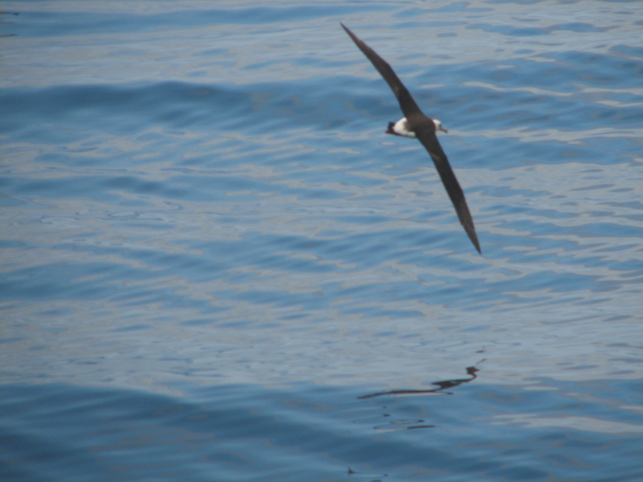
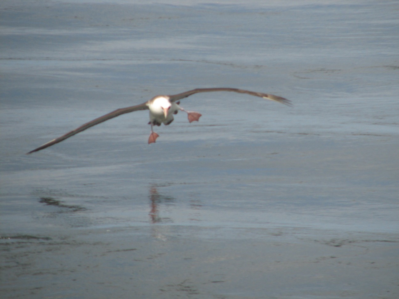
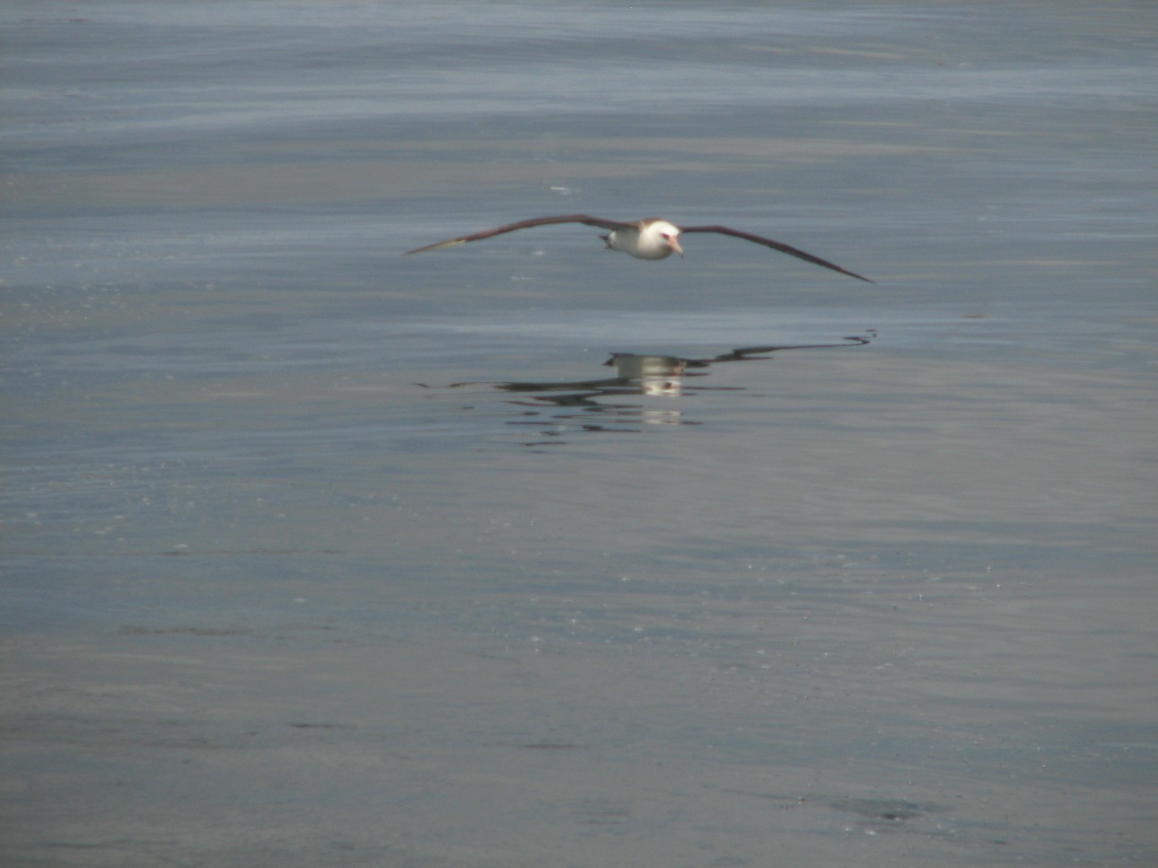
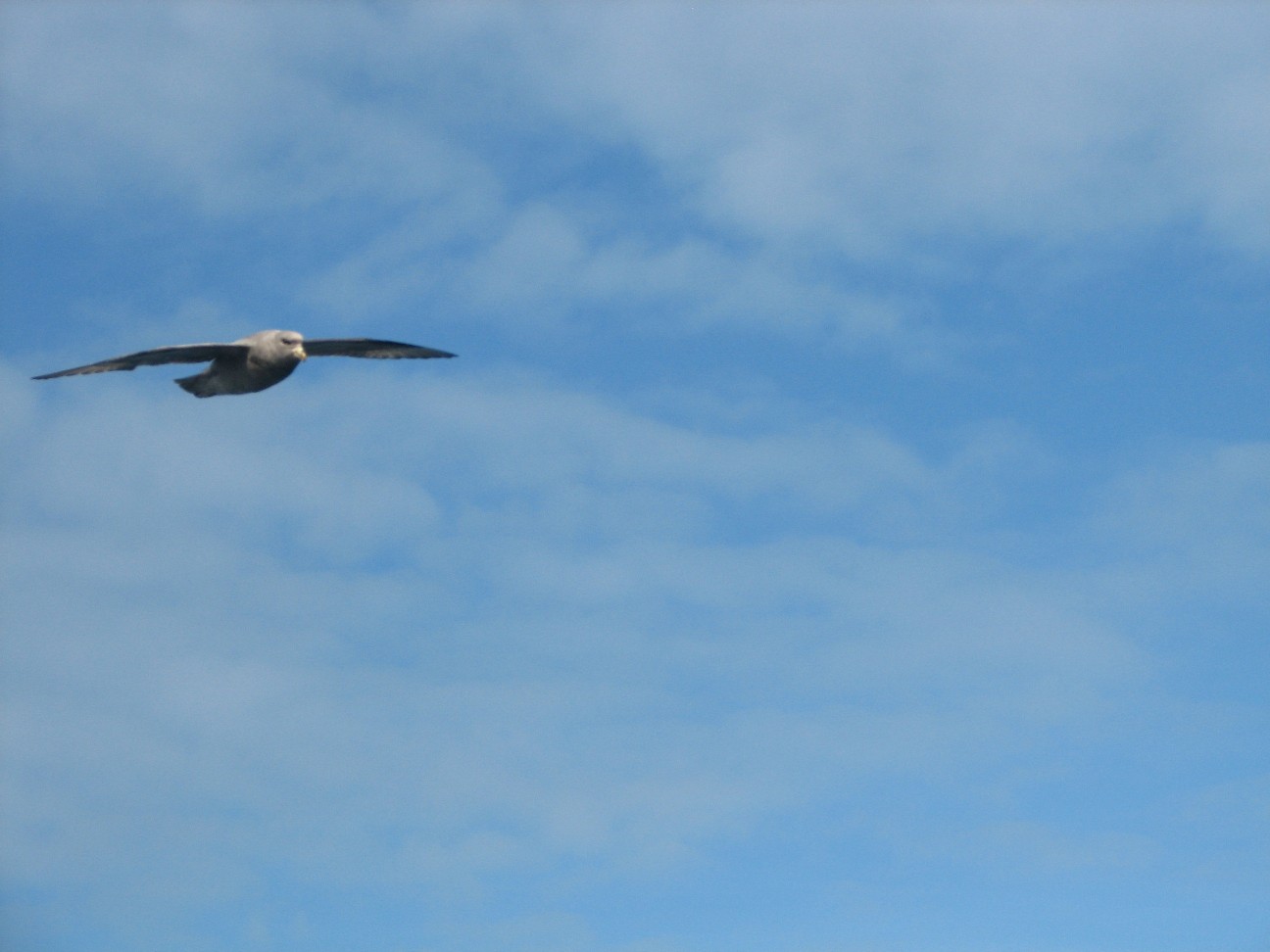
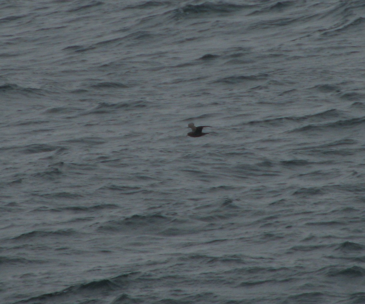
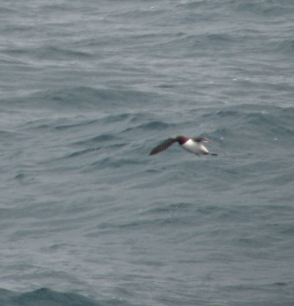
This is a bird called a Laysan Albatross. It is a huge bird that soars along the water and hardly seems to move its wings at all. What a beautiful site. The picture at the top is also a Laysan Albatross. My favorite photo is the one that I call "Landing Gear Down." Can you guess which one that is?
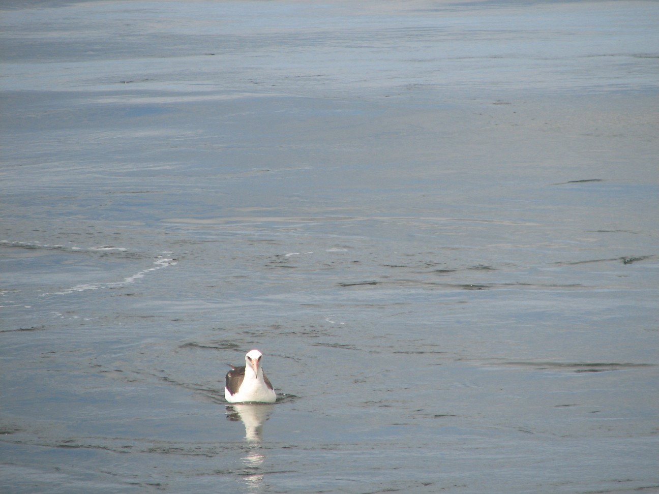
This is a bird called the short-tailed abatross. There are three albatross in this photo. The rare one is the darker colored one in the center. It is a juvinile, or young short-tailed albatross. It is a rare bird that was once close to extinction, but has started to come back. It nests in Japan and comes here to the Bering Sea to feed. This explains why it was sitting in the water just as our fishing nets were being hauled in. Like many sea birds, one of the threats to this species is discarded plastic, which often winds up in the sea and floats. Sea birds, such as the short-tailed albatross eat this plastic, thinking it is fish. Plastic gets into the stomach of many birds. They can’t digest it and it often gets stuck and takes up space. Birds with plastic in their stomachs may not get enough real food to eat and can die.
This next bird is a common site here. It is called the Northern Fulmar.
This next photo shows a fish that came up in our nets. When you are fishing for one kind of fish, such as pollock, you will almost always get a few other sea creatures in your net. These extra fish are called weighed and recorded by the scientists. Our catch yesterday was very interesting. Take a look at some of what we found:
This fish is called a lamprey. It looks like an eel, or a snake on land. It has a ring of sharp teeth in its mouth and will latch on to a fish and hold on. Sometimes for a long time. It eats as it holds on. Ouch. It is one of the earliest kinds of fish. The species is even older than sharks.
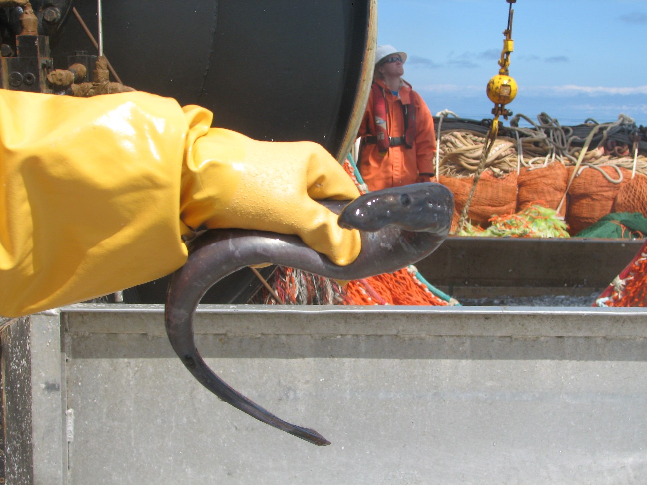
This next fish is called a skate (it is the darker one with the long thin tail). You may have found a skate case when you are walking down the beach. Skate cases are black rectangles with a spine coming off of each corner. A skate case is what the skate lays its eggs in. This is what an adult skate looks like here on Aleutian Islands.

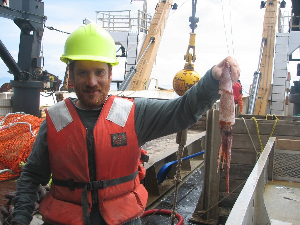
The last next photos show a tanner crab and a squid. We seem to catch a lot of squid in our nets around here. They sure are interesting looking.

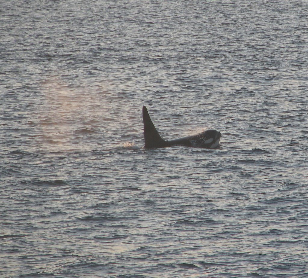
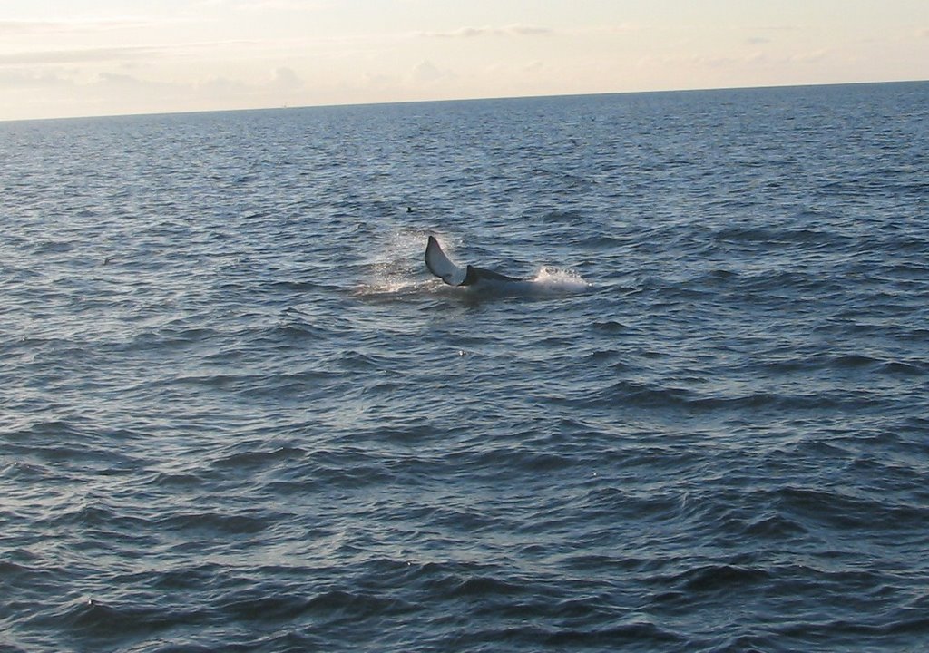
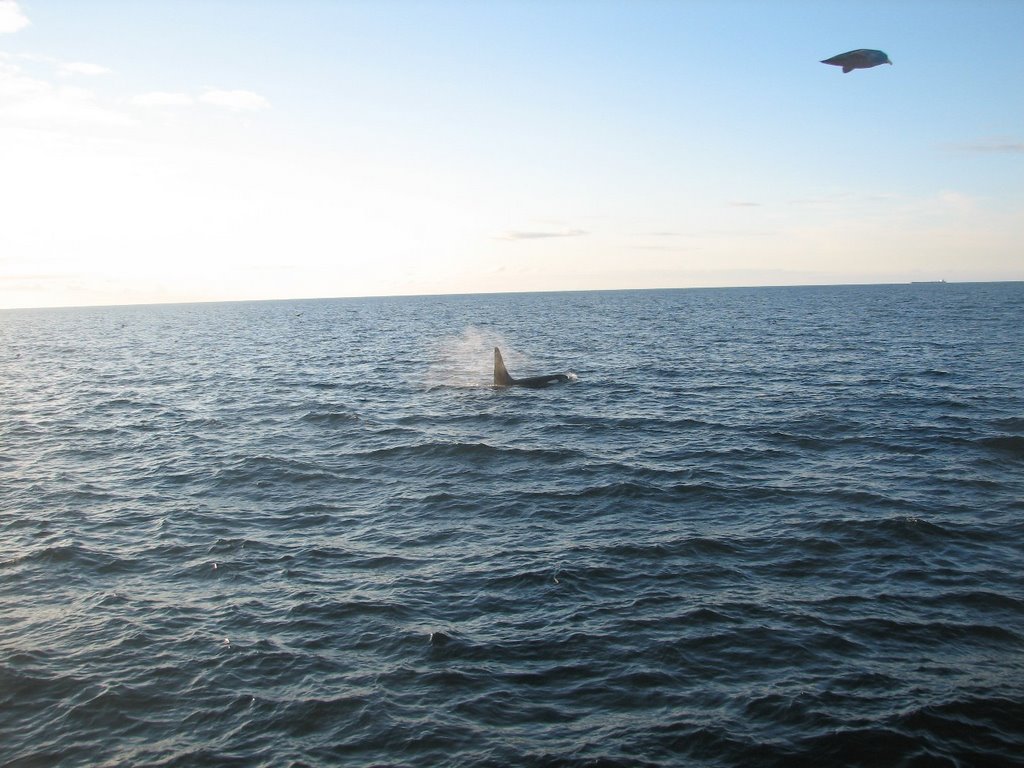
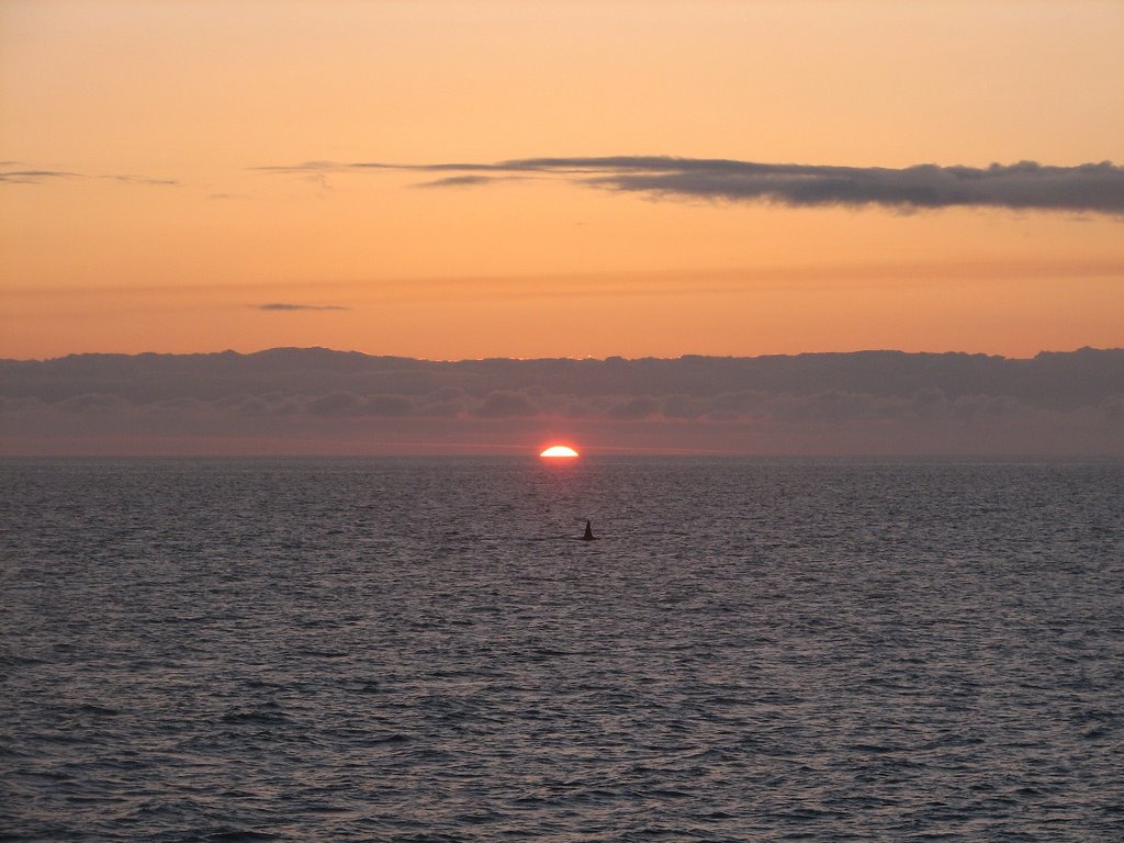
There were the whales. A pod of three killer whales, or orcas circled our ship for hours and hours last night. Here are a load of pictures, and click here for a video!
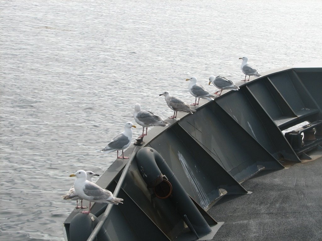
A group of Glaucous-winged gulls stayed on the bow of the ship, right in front of where the Captain sits. A few of us nicknamed them the Board of Directors. They certainly looked like they were in charge of things.
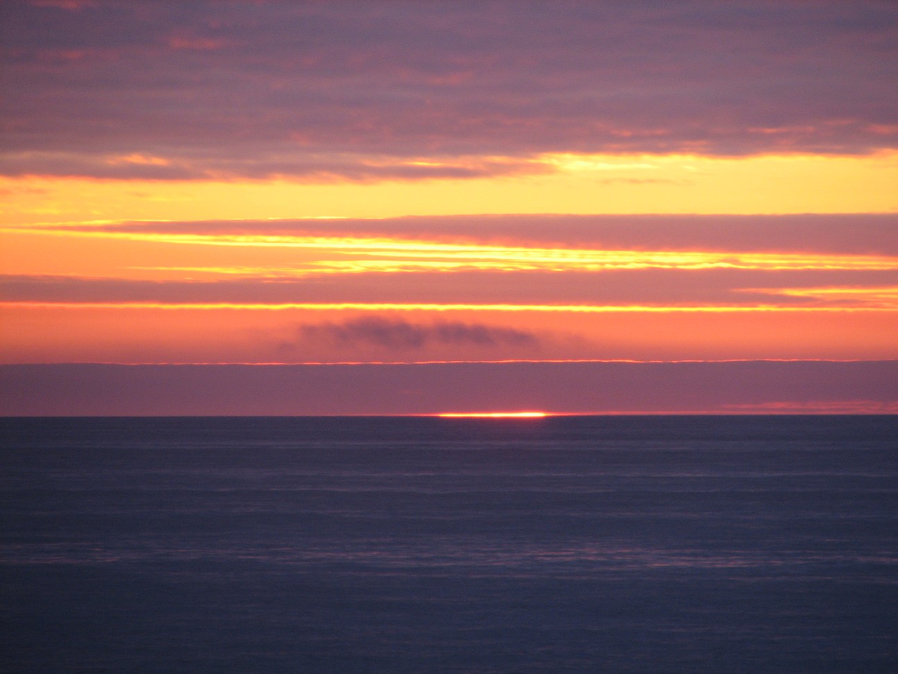
Finally there was the sunset, the moonrise and the sunrise again. I was awake for all of them, and in Alaska in June, that is not easy. The sunset and sunrise here take a very long time to happen. The sun comes up and goes down at an angle, rather than straight up, it takes much longer than it does at home. When you are watching a beautiful sunrise or sunset, that can be a wonderful thing. Something else happened that Mrs. Christie-Blick in Cottage Lane told me about before I left; The sun flashed green just before it went down. Can you see it on this video? Click here to see the video. Why does it turn green? When the sun is very low in the sky, it’s light has to pass through a lot of air, which can bend light like a prism and can change its color. Click here for more information. The first photo shows the sunset. Can you see the fin of an orca? Remember to click the photo to make it larger. The second photo shows the sunrise. Just a few hours later.
Science Log:
Work on the pollock survey continues. We brought up hauls last night and this morning and scientists are busy processing data from each. The bird survey also continues.
Question of the Day:
Click on the link below and look at our speed. How far will we travel in 24 hours?
http://info.nmao.noaa.gov/shiptracker/Ship.aspx?ship=Miller%20Freeman
Answer from Yesterday
Where do you think the food on the ship comes from? Read and listen to the interview with or chief cook, Russle Van Dyke tomorrow to learn the answer.
Answers to your Questions:
Hello to all of you, new friends and old!
Ms. Farry’s Class, The pressure reading can help you know if the weather is going to clear up or to rain. When the pressure drops, the weather often turns to rain (or if it is very cold, snow). The bigger the drop, the stronger the storm. We will learn more about that next year when you are in 4th grade. I look forward to working with you, and by the way, I love teaching from the ship and from the classroom. By the way, most of the fish that we see are counted only using the sonar. Which does not hurt them at all. The scientist take some samples of the fish that they see that go back to the lab for study. Others fish that we catch are put back into the sea.
We are catching lots of strange creatures in our nets. Check out the photos today to see more.
Mrs. Bowler. Thanks for writing. It does seem like the pollock are not in this area. Sometimes, in unusually cold years, like this one, the pollock migrate to other parts of the Bering Sea waters because their food source moves..
I’m glad you like Rusty, Mr. Kolman-Mandle’s Class, and yes the volcanoes were very cool, in a very warm sort of way. I enjoyed seeing them.
Ms. Beglin’s class, I have not seen any walrus on the trip so far. They are usually further north than we are right now. We have seen some northern fur seals, but I could not get a good picture. I’ll keep trying. See you in September. Have a great summer. Keep checking the blog!
Mrinalini: Thanks for writing. You are right, I am learning tons. It is wonderful to have a ship full of experts who can answer all of our questions, mine and everyone else’s so easily. Global warming would impact species like Pollock, but between natural variation, the impact of fishing and global warming, it is very hard to tease out exactly what is caused by which factors from year to year. It is interesting to see the different opinions among scientists on this topic. There are many. The main area of concern with the pollock is the fact that it is the largest fishery in the USA. Our survey will be used to help set fishing quotas in one of the largest the fishing industries in the world.
Mr. Sharkey’s Class: The deck can sometimes be cold. Especially at night. I sleep near the engine room, which is always warm. I sometimes don’t even need a blanket. The survival suit is kind of like putting on pajamas. It does not take long at all. None of us have been seasick since the one storm we have seen so far abated. So far, so good. Thanks for writing. By the way, yes there are sharks, but we have not seen any so far. I’ll keep you posted.
Mrs. Minor’s Class, Hi. I do miss my family and my students. I do love being on the ship. It is much harder for the crew on the ship who are away from their families for many months at a time. I have been seasick once and only once. It is the only thing I did not like about being on the ship. But it is all part of the experience. Thanks for writing.
Ms. Christie-Blick : I hope yesterday’s interview with Dr. Stepanenko helped answer some of your student’s questions. Let me knw.
Thanks all for writing
Photos:
All of today’s photos are described in detail in the context of the blog.
Monday, June 12, 2006
NOAA Teacher At Sea: Jacob Tanenbaum
NOAA Ship MILLER FREEMAN
Mission: Bering Sea Fisheries Research
Day 12: June 12, 2006
Weather Data from the Bridge:
Visibility: 14 miles
Wind Speed: 3.4 miles per hour
Sea Wave Height: 1 feet
Water Temperature: 43 degrees
Air Temperature: 51.4 degrees
Pressure: 1011.5 Millibars
Personal Log
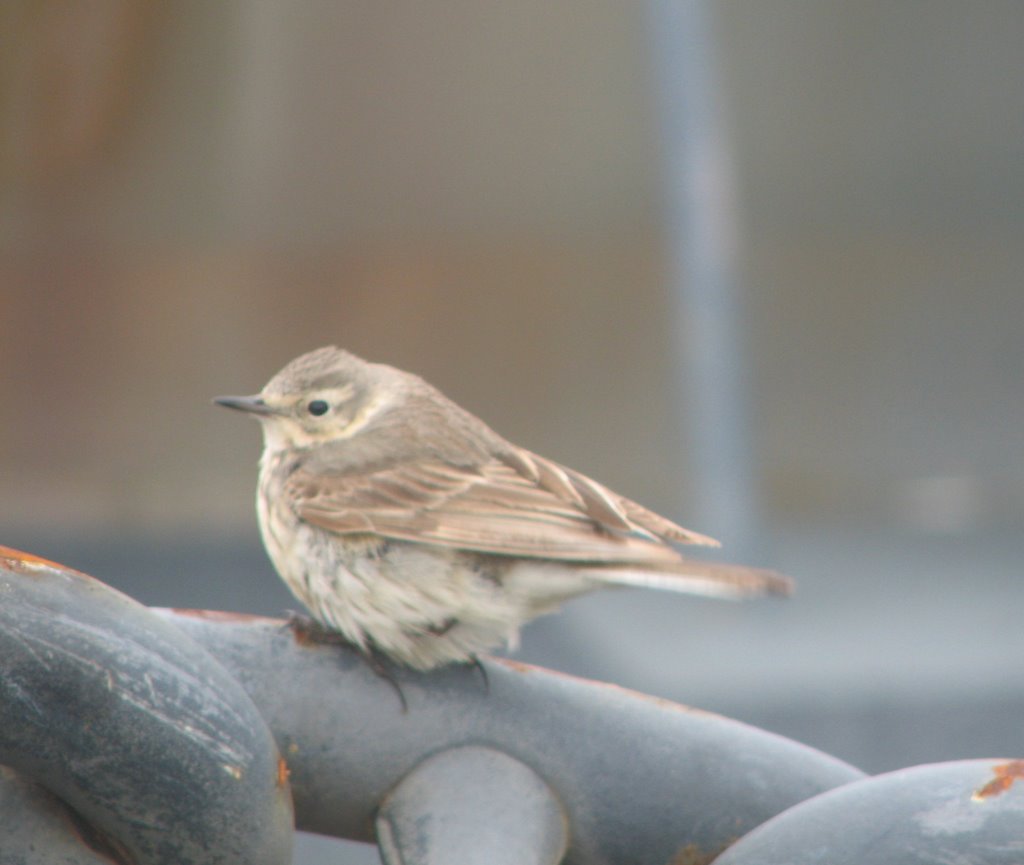
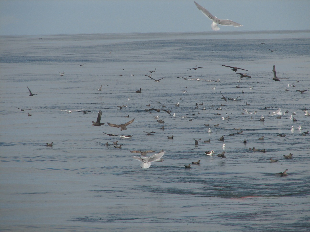
We had a visitor from land today. This little sparrow stopped for a rest on our anchor chain. When this land bird appeared, we were about 80 miles out to sea. How did it get here? It was also a great day for viewing wildlife. Whenever we have a trawl go out, there are always birds circling the ship. Take a look at these photos of our net out and the birds around it.
Science Log
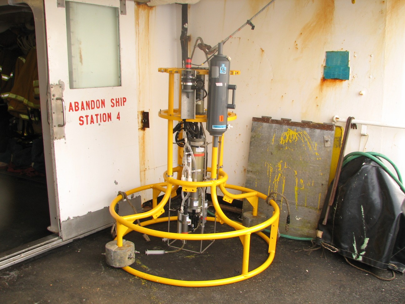
Last night we lowered a different kind of echosounder over the side of the ship. Our main
 echosounder array is mounted to the bottom of the ship. The one we were working with last night can be lowered hundreds of feet down into the sea. It allows you to see the fish from a different perspective. We used a winch to raise and lower the echosounder. Since we were working with heavy equipment and were leaning over the side of the ship while we brought the sensor back on board, we were wearing life jackets, hard hats and were tethered to the side of the ship using belts and ropes.
We are not seeing many pollock right now. We have not slowed down to fish so we are a little ahead of schedule at the moment.
In the last 5 days, I have sent back video on the each part of the pollock study. Here is a list:
What is Sampling
How the echosounder works
How the trawl works
Now lets do one more. This new video explains the entire study from end to end using material from each of the videos above. Click here to watch.
Let’s meet one of the scientists on board NOAA Ship MILLER FREEMAN: Mikhail Stepanenko is a scientist from the Pacific Fisheries Science Center in Vladivostok, Russia. Click here to see Vladivostok, Russian using Google Earth. Dr. Stepanenko monitors the Bering Sea stock of Pollock, because his country is on the other side of this body of water. Click here to listen to him explain who he is and what he is studying. His data will help establish something called the total allowable catch. This is the number of pollock that can be safely caught without causing harm to the species. This number is used to help establish quotas. A quota means that each fishing vessel may catch only a certain amount of pollock.
Click Here to listen
The Bering Sea is a body of water that is shared by the United States and Russia. A convention line, or boarder, runs between our two countries. This line is also the international date line. Pollock, of course, no nothing about lines in the water and swim freely between our two countries. If we are to keep fishing these waters without harming the species, we must work together. Dr. Stepanenko explains the importance of this in the next download.
Click here to listen
There are parts of the Bering Sea that other nations also fish in. Dr. Stepanenko helps set the Total Allowable Catch for his country, but what about the other countries that come to fish here. Dr. Stpanenko explains how complex it is to get everyone to agree in the following download:
Click here to listen
Question of the Day:
Where do you think the food on the ship comes from?
Answer to the Question of the Day:
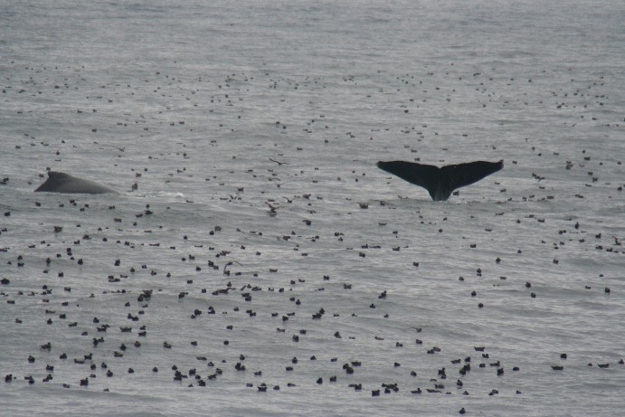
Yesterday, biologist Tamara Mills snapped the photo of humpback whales and a flock of birds all in the same area. You can see the photo at the top of the blog today. There were thousands of birds and about 7 whales. Why do you think they might be in the same area?
The answer is simply food. There was a lot of krill in the water in this spot, which attracted both the whales and the birds.
Answers to Questions:
The deck of the ship smells a lot like fish when we are dong a trawl, but other times, the sea breeze keeps the air very fresh. I like being on deck very much. Snuggy did not get seasick at all on the trip. Lucky bear!
I think we are lucky to have such a great engineer. I’ll pass your comments on to him.
The largest pollock we have caught so far was 3.6 pounds. The longest was 23 inches, or just under 2 feet. None of us could life such heavy nets. We used a cranes and winches to move the nets.
Counting 50 million birds is not possible. Scientists count the birds in certain areas of the Bering Sea and use the information to estimate the total.
The jellyfish we see are not the kind that sting (thankfully). So no one has gotten hurt. The only real danger from the jellyfish, between you and I, was looking at a basket full of them while seasick. Yikes!
I asked the biologists how pollock protect themselves from predators. They explained that pollock’s best defense is to lay thousands and thousands of eggs. Very few actually survive into adulthood. If the pollock each lay enough eggs, though, it will ensure that at least some of them will become adults and have babies themselves.
A lot of people have been asking about the weather. Today it is degrees. I do not think it will get a lot warmer this year. This is probably about it.
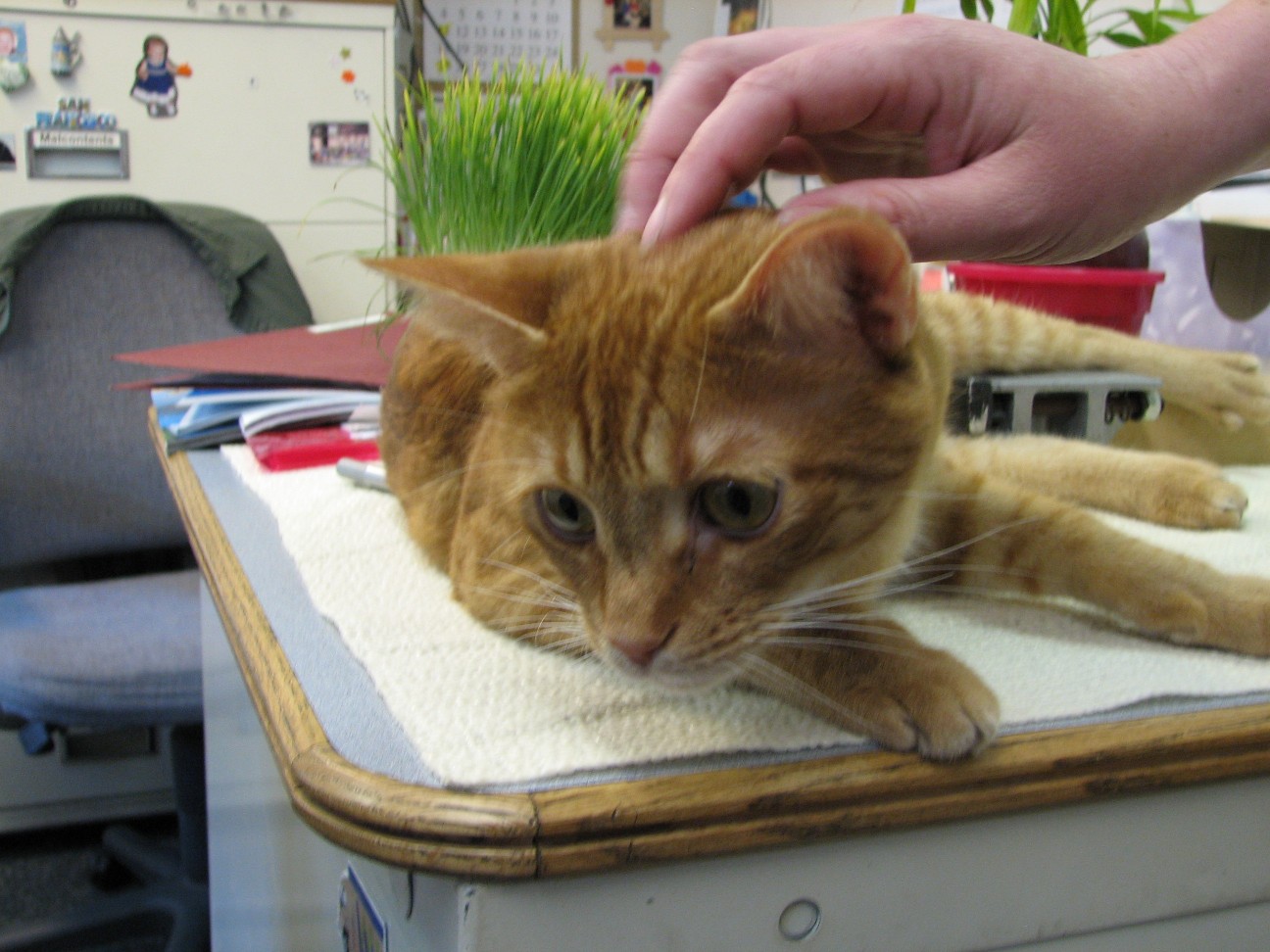
I’m so glad you all like Rusty. He loves being on board and has a great time getting all the attention. He does not go in the water. He stays on the ship. Why do the crew have a cat? Well, remember, this crew spend most of their year on the ship. This really is their home. Like many people, they enjoy having pets. When Yeoman Huber suggested the idea to the crew, they had a vote and decided to adopt Rusty together, just like a family would. They also voted on the name for their cat. First, they all suggested ideas for the name, then, they put the question to a vote. Rusty has a favorite game as well. He loves to sit behind the mail slot in ship’s office wall. When someone walks by in the hallway on the other side, he sticks his arm out and bats you. Surprise! It’s lots of fun.
Hi to my brother. I am not tired of being at sea at all. I love every minute of it. I will say that the Bering Sea is a cloudy place. We really have not seen many sunsets or sunrises. The clouds just get a little brighter and a little darker. I’m glad I stayed up all night in Three Saints Bay to photograph the few that we have been able to see. The sunrise in Three Saints Bay took about 3 hours and was spectacular.
Photos:
A visitor from land – A sparrow lands on the anchor chain of NOAA Ship MILLER FREEMAN while we are 80 miles out at sea.
Birds circle the trawl net (2 photos)
The "Drop Transducer" on NOAA Ship MILLER FREEMAN
Dr. Mikhail Stepanenko
Sunday, June 11, 2006
NOAA Ship MILLER FREEMAN
Mission: Bering Sea Fisheries Research
Day 11: June 11, 2006
Weather Data from the Bridge:
Visibility: 11.5 miles
Wind Speed: 9 miles per hour
Sea Wave Height: 2 feet
Water Temperature 42 degrees
Air Temperature: 43 degrees
Pressure: 1005.5 Millibars
Personal Log
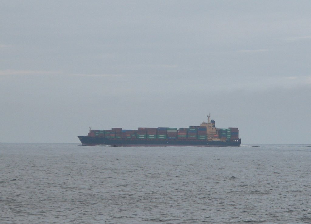
Last night, we turned around in Unimak Pass at the end of one of our transact lines. This unique part of the Aleutian Islands separates the Gulf of Alaska from the Bering Sea. Click here to see Unimak Pass using Google Earth. There were whales and thousands of sea birds. We also saw some of the many ships that pass through the area on their way across the Pacific Ocean.
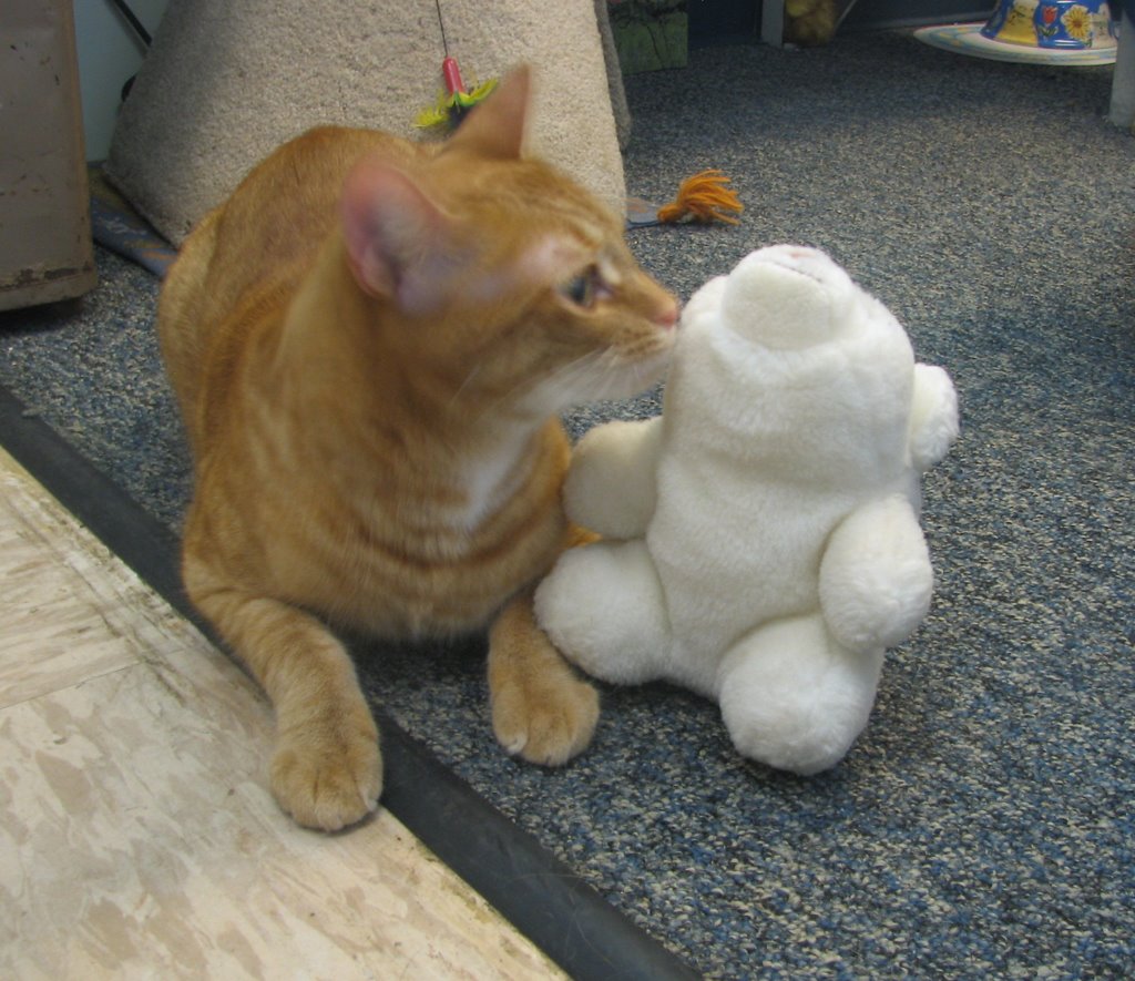 We also had some fun today introducing Rusty the ship’s cat to
 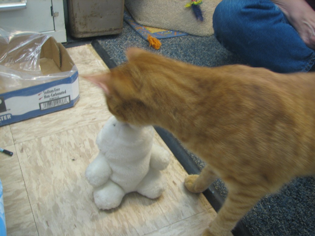 Snuggy the bear. They had a good time together. Here are a few pictures.
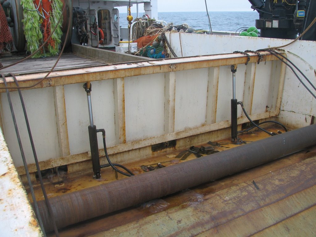
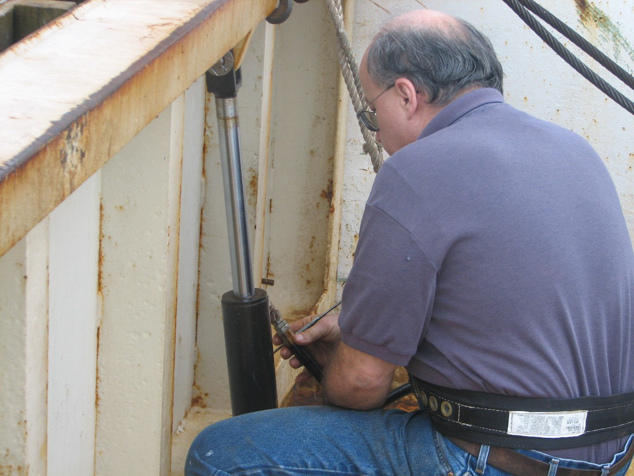
On a ship at sea, when something breaks, you can’t drive over to the nearest gas station to get it fixed. Today the hydraulic line on the trawl door on the back of the ship began to leak. The trawl door has to open so we can put our nets in the water. Without the hydraulics working right, we can’t fish. “Are you going to call triple A?” I asked Steve Bus, the Chief Engineer on NOAA Ship MILLER FREEMAN, referring to a service that tows your car when it breaks down. “Out here, I am triple A,” he said as he gathered his tools. The crew on the ship has to be prepared to fix just about anything that breaks out here. They even have a machine shop where they can make new parts if necessary. In this case, Steve fixed the hydraulic line in just a few minutes and we are back in business.
Science Log
We are seeing more fish now as our transact lines take us over deeper water. We are putting out the nets more and more and we are getting good samples of fish. It is a fascinating process to watch and participate as the nets are lowered and raised and a thousand pounds of fish are analyzed. Would you like to see how it is all done? Just click here for a video. Do you think catching a thousand pounds of fish is tough to do? Just imagine a large commercial trawler. They typically catch between 60,000 and 160,000 pounds of fish each time they put out their nets.
Lets meet one of the scientists:
Michael Guttormsen from the Alaska Fisheries Science Center in Seattle Washington
What are you studying on this survey
Listen to the answer
What is your specific job here on the ship?
Listen to the answer
When the results of the study are known, what will become of them?
Listen to the answer
What advice do you have for young people who might be considering science as a career?
Listen to the answer
It was interesting to hear how the data from this study will be used to create limits to the amount of fish that fisherman are allowed to catch. These limits are called quotas, and they are one of the most important reasons NOAA Ship MILLER FREEMAN is out here studying pollock right now. This study will help set the quota for the coming season.
Question of the Day:
Yesterday, biologist Tamara Mills snapped the photo of humpback whales and a flock of birds all in the same area. You can see the photo at the top of the blog today. There were thousands of birds and about 7 whales. Why do you think they might be in the same area?
Answer to Yesterday’s Question:
Look at the echosounder video. Why do you think they cannot tell a male from a female with the sounder?
Male and female pollock are the same basic size and shape They would not look different on an echosounder. The only way to tell males from females is to bring them up and have a look.
Did you check the blog yesterday? Don’t forget to watch the echosounder video as well. Just click here. Did you know you can scroll down or click the links on the left to read past blog entries?
Photos:
A container ship in Unimak Pass
Birds and whales in Unimak Pass (Photo by Tamara Mills)
Rusty the Ship's Cat with Snuggy the Bear (2 photos)
Trawl door on NOAA Ship MILLER FEEMAN
Chief Engineer Steve Bus repairs a hydraulic line on board NOAA Ship MILLER FREEMAN
Scientist Michael Guttormsen in the acoustics lab on board NOAA Ship MILLER FREEMAN
Saturday, June 10, 2006
NOAA Ship MILLER FREEMAN

Mission: Bering Sea Fisheries Research
Day 10: June 10, 2006
Weather Data from the Bridge:
Visibility: 11.5 miles
Wind Speed: 8 miles per hour
Sea Wave Height: 4 feet
Water Temperature 42.3 degrees

Air Temperature: 48.2 degrees
Pressure: 998.5 Millibars
Personal Log
Today is a quiet day. The waves are much lower and all of us are feeling much better. We are also getting used to being at sea. One thing that is interesting to me is learning how to walk when the room is moving. It requires a lot more thought or you wind up bumping into people, chairs and even walls and doors. It is easy to get hurt on a ship if you are not careful. If walking is not difficult enough, try lifting weights when the gym is moving. You get your back straight and ready to lift and suddenly find yourself leaning way over to one side because the room shifted. Perhaps the best work out of all would be 30 minutes of trying to stand still!
Here on the ship, the word weekend does not mean much. Everything continues as usual. Someone must steer the ship, someone must cook the food, someone must keep the engines humming, so the crew does not take breaks just because it is a weekend. Being at sea is hard work.
On the bridge off of Unimak Pass, we saw one of the largest flocks of a kind of birds I’ve ever seen. They were mostly shearwaters, which are a common up here. Have a look for yourself. The pictures are at the top of the page. Click the pictures to make them larger. You will see the birds better if you do.
Science Log
The survey continues. We had another haul of fish last night and one this morning. It wa
 s quite a haul. We caught 1268 walleye pollock as well as a
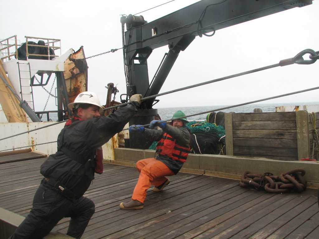
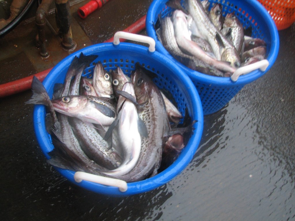
 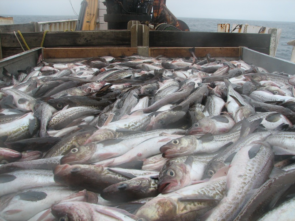 few other types of fish. The pollock weighed almost 1000 pounds. Take a look at some of the photos of the nets being brought in. It is amazing to watch. All of us wear hard hats and flotation devices (life jackets) when we are working on deck. Safety is a big concern with huge nets being dragged in on steel cables.
We are continuing on across the Aleutian Islands now making lines going north to south that are around 180 miles long.
The highlight of the day today was learning more about how the echosounder operates. This is a fascinating device that can see the fish down deep in the water. It can tell you how deep the fish are swimming and sometimes what kind of fish they are. Take a look at this video which explains more.
Question of the Day:
Look at the echosounder video. Why do you think they cannot tell a male from a female with the sounder?
Answer From Yesterday:
What causes seasickness?
Seasickness is caused when the fluid in your inner ear, which helps you keep your balance, is in constant motion as the ship rocks. Your eyes are looking at a room inside the ship, which often does not look like it is in motion. Your insides also move with the rocking of the ship. When they all combine, you can get disoriented and become ill. Click here for more information. If you ever do get seasick, try British Admiral Nelson’s foolproof remedy for the problem (he was quite prone to it in spite of a life on the water). To cure seasickness, he said “you’ll feel better if you sit under a tree.”
A special hello to my family, my two boys Nicky and Simon, and, of course, Annie, Misha and Jasmine.
Photos
Birds off of Unimak Pass (2 photos).
Nets being hauled in by Matt Faber and Michael O’Neil of NOAA Ship MILLER FREEMAN
Fish ready for processing
Teacher at Sea Jacob Tanenbaum with nets and with pollock.
Friday, June 09, 2006
NOAA Ship MILLER FREEMAN
Mission: Bering Sea Fisheries Research
Day 9: June 9, 2006
Weather Data from the Bridge:
Visibility: 9 miles
Wind Speed: 24 miles per hour
Sea Wave Height: 10 feet
Water Temperature: 39.7 degrees
Air Temperature: 39.3 degrees
Pressure: 992 Millibars
Personal Log
Well the Bering Sea decided to show me where the legends come from and whipped up a nice size gale for us last night. The waves were crashing over the decks and slamming into the ship along with sleet, hail and rain. The works. One of us described going to bed last night as being rocked to sleep by Godzilla. About a third of the ship are feeling sick. I’ve been pretty badly off for the last 24 hours or so. I lasted through the first part of the gale just fine and then it hit me all of a sudden. I am not the only one, though. Breakfast and lunch have been very poorly attended. The wind is supposed to last into tomorrow, but it does seem to be a little calmer. The crew all say that when you get sick like this, it usually wears off after a few days and then you have your “sea legs.” All I can say is, I hope I get them soon.
Science Log
 Last night we had our first haul of Walleye Pollack. Here is how it all works. The scientists see pollock below our ship using the sonar. They call the
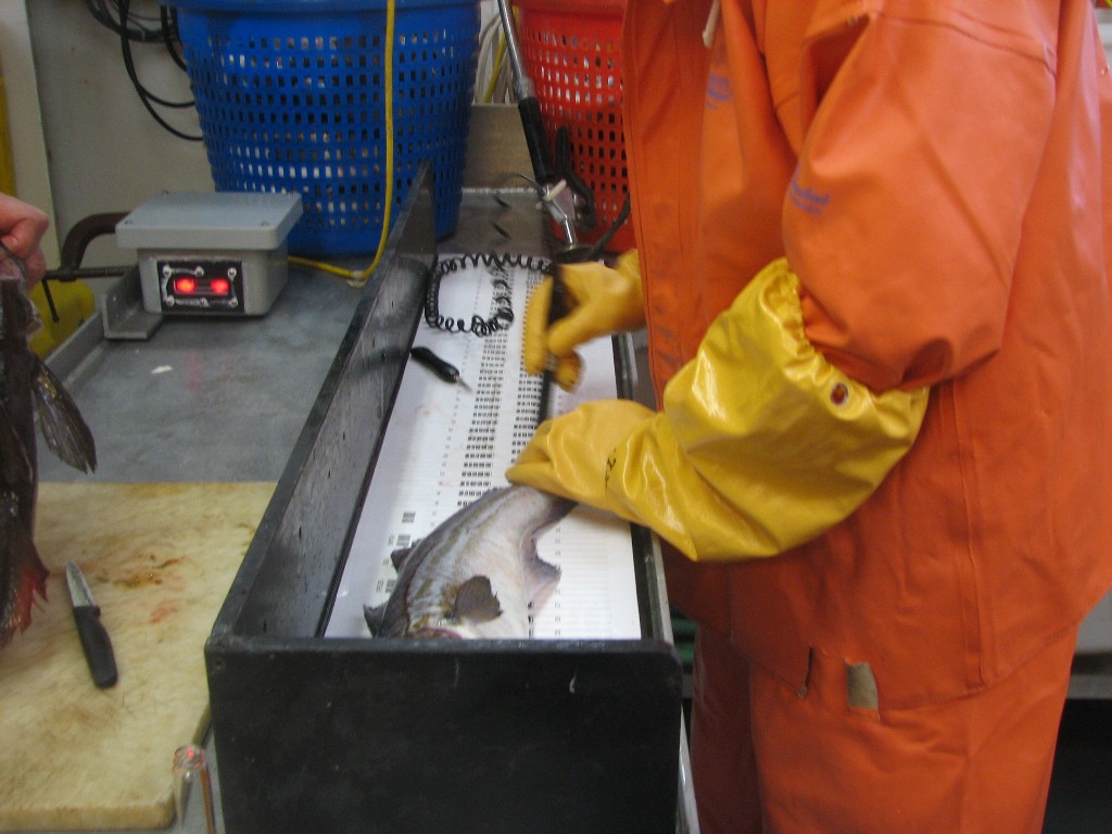 bridge and the deck crew goes out and lowers nets off the back of the ship. We drag the nets (called trawling) until they have enough fish and then bring them back on board. Once the nets are on board, the science crew and I go to work. We sort the fish and any that are not Pollock are weighed and then go over the side. The pollock go into a lab where they are weighed, measured and recorded. Each one individually. They also record other information about the fish. Including whether it is a male or female. Then we put them over the side back into the water. The recorded information goes into a database which is compared with the information from the sonar. Using techniques like this, we know a lot about the fish that we see using the sonar. This information is collected and scientists will decide if the population of pollock is healthy. Governments use this information to set limits on what fisherman catch so that the population stays healthy from year to year. Take a look at this video where you can watch the nets coming back in. Look at how big the waves are!!
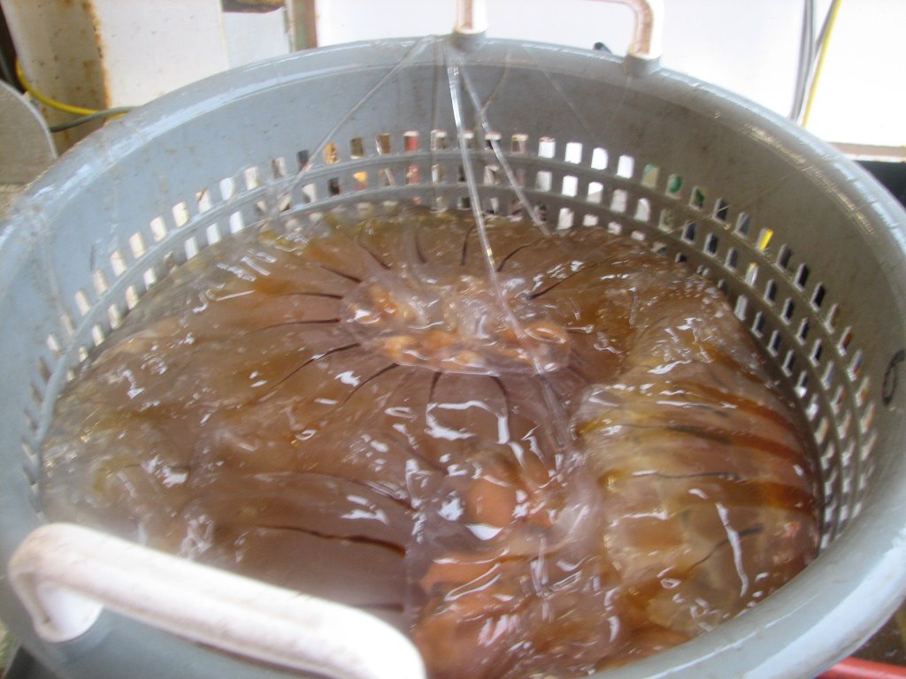
Our first haul included about 150 pounds of Jellyfish. Which we scooped out and put over the side.
Answers to Questions:
Many of you wrote back today. Thank you so much for all your responses. First, we have not seen any monsters. The sea has been ferocious enough, thank you, so I’m glad to report that
 there has been nothing worse than a storm on the Bering Sea. I’m glad you like Rusty. Here is another photo. The weather has been mainly chilly and wet the last day or two. The sun has gone behind the clouds and just won’t come out.
Mrs. Neugebauer's class, I do like being at sea, in spite of the discomfort. I know it will get better soon. By the way, we have lots of life rafts on board. Plenty for everyone. When we have the drills, I have to stand by life raft number three. That is my assigned spot.
Mrs. Narciso's class, the sound you heard in the video was the sound of the water slamming against the side of the ship and against my port-hole where I filmed that video.
Ms. McDonald’s Class, yes we found Pollack today. I’m so glad. By the way, eat fish sticks and tell me if you think you like eating Pollack. If you eat fish sticks, there is a good chance that you are eating Pollack from the Bering Sea.
A lot of you asked if my survival suit was heavy and hot. It is both. Mainly heavy. The equipment on the front keeps the water out, and there is a small area that inflates to keep you floating.
Though we have seen Pollack, we have not seen any sharks.
Several people asked where we sleep. I have a small room that I share with 3 other men. We each sleep in a bunk, or rack. Don’t fall out if your on the top one. It’s a long way down and the floor is made of steel! The ship keeps going and the work keeps happening all the time while we are at sea. That means in our cabin, two of us are usually on duty and two of us are usually off duty sleeping. So you have to be very quiet. But it is comfy and I have snuggy for company as well.
By the way, if you miss reading the earlier blogs, you can scroll down to read some of the older entries. You can also click on the archive link on the left to see more.
Mrs. Murphy’s class, you can read about my job up top. The food is great. It is prepared by a wonderful staff in the galley who even give me advice on what to eat when my stomach is not so happy.
Hello to everyone who wrote. Peter, Abbie, Kyle and Ilia. Nice to hear from you.
Un saludo especial para los que hablan espanol.
Question of the Day:
What causes seasickness
Answer to the Previous Question:
There is no way to count all the fish in the sea. Scientists develop very sophisticated ways of estimating that are remarkably accurate. But nothing will give you an exact count.
Photos:
Fish in a basket ready for study.
Jellyfishing! Jellyfish sorted, weighed and ready to be thrown back into the sea.
Pollock on board NOAA Ship MILLER FREEMAN
Scientists on NOAA Ship MILLER FREEMAN weigh and measure fish caught in the nets.
Rusty the ships cat.
Thursday, June 08, 2006

NOAA Teacher At Sea: Jacob Tanenbaum
NOAA Ship MILLER FREEMAN
Mission: Bering Sea Fisheries Research
Day 8: June 8, 2006
Weather Data from the Bridge:
Visibility: 14 miles
Wind Speed: 17 miles per hour
Sea Wave Height: 3 feet
Water Temperature: 42.8 degrees
Air Temperature: 47.75 degrees
Pressure: 1006 Millibars
Personal Log:
Thar she blows: A few of us spent the evening on the bridge of the ship watching birds and whales last night. Here are a few pictures to share with you. The splash is from a minke whale who was swimming just off of our bow. The birds include northern fulmar, pelagic cormorant, and a common murre.

Do you remember that Kris Mackie talked about diving under the sea ice during a mission in April? I found a web site that talks about the mission. Click here to access the site, and click here to access some photos of divers from NOAA Ship MILLER FREEMAN under the sea ice. Don’t forget to scroll down in order to see the pictures of the sea ice!
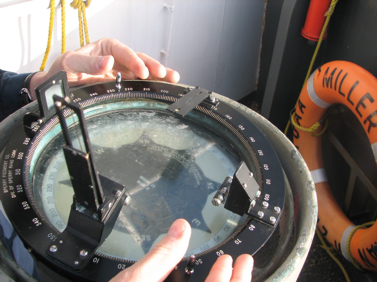
Here is something interesting: Even though NOAA Ship MILLER FREEMAN has some of the most advanced navigational equipment anywhere, they still use the sun to make sure that they know their exact position. In this series of photographs, Ensign Matt Davis places a device called an azimuth circle over the compass on the wings of the bridge. When he aligns the device towards the sun, it projects a line of sunlight across the compass face. You can see the line in the second photograph. He next takes the height of the sun, our latitude, our time of day and other numbers and, with the help of a large set of look-up tables, he calculates what the compass should be showing. If the compass is off, even by a little, Ensign Davis will find out.


Today, the nice sunny day you see above turned into a full fledged gale with 10 foot waves and higher. There was even some sleet (that cold mix of snow and rain we are so familiar with). Take a look at some video!! And don't worry. The boat is fine and I'm not sea sick at all.
Science Log:
We are still looking for Pollock, but we do know the most likely reason we are not seeing very many. Last night, we dropped a sensor array over the side of the ship and found that
 that area we are traveling in is very cold just below the surface. Though the surface temperature is now over 40 degrees, the sensor found the water was 35 degrees as soon as you get below the surface. Why? The area we are in was frozen over for much of the winter. Though the ice has melted, the areas below the surface have not had a chance to warm up yet. Walleye pollock prefer slightly warmer waters. Around 40 degrees or so. Later in the day, we will get to a deeper section of the Bering sea. Even though the surface of the sea may freeze, far below the surface, the water tends not to cool down as much over the winter. The walleye pollock usually stay in those areas until the shallow areas warm up a little more.
Question of the Day
Why do you think deeper water stays warmer in the winter than shallow water?
Answer to the Previous Question.
Because the Bering Sea is so vast, there is no way to count the exact number of Pollock, or any other species of fish. The best we can ever do is an estimate.
Answers to your Questions:
I see you have a lot of questions about the mountain goats from the other day. I did a little research on the animals. Everyone on the ship was calling them mountain goats the other day, but the actual name for them is Dall Sheep. If you would like more information, here is a link. They really are an amazing creature: http://www.adfg.state.ak.us/pubs/notebook/biggame/dallshee.php
A lot of people have asked me if I have been scared at all on this trip. No, not at all. Everyone around me from the airlines personnel to the NOAA Corps have been very professional and knowlegable. I have been very at ease the entire time
Thankfully, I still have not been sick at all. Today was probably our roughest day so far, but the waves have been very gentle.
It has been fun to see volcanoes and eagles. I still love the wildlife in New York as well. I find each place I have been to has a unique beauty. You just have to learn to look for it. There is nothing like autumn in New York. Whenever I get a good picture of wildlife, I will post it for you. I’m getting better at taking pictures fast. So lets hope for some good ones.
Rusty is cute. If you don’t get to hear or read something on the blog, try clicking archive on the left side. You can get to any of the past entries and hear or read them all you want.
I have not had trouble sleeping at all. I am now on the day shift, from 4:00 AM to 4:00 PM. Since we are not catching fish, I have had a lot of time to work on this blog and do laundry. There is also a gym on the ship and I go there and exercise each day. It’s very nice.
I will take lots of pictures and video of our first haul with the nets. Right now we are all just working with the sonar so there is not much to show. I’ll keep you posted.
Thanks for writing.
Wednesday, June 07, 2006
NOAA Teacher At Sea: Jacob Tanenbaum
NOAA Ship MILLER FREEMAN
Mission: Bering Sea Fisheries Research
Day 7: June 7, 2006
Weather Data from the Bridge:
Visibility: 11 miles

Wind Speed: 13 miles per hour
Sea Wave Height: 1 feet
Water Temperature: 43.5 degrees
Air Temperature: 44.2 degrees
Pressure: 1010.2 Millibars
Personal Log:
The Bering Sea is slate gray and cold. Right now it is calm, but its storms are the source of legend. It is amazing to be here and think that the bottom of this sea is what the Native Americans walked over during the last ice age. The sea levels were lower back then, and what we are sailing on was dry land back during the ice age. And it was warmer here than it was in New York back then, so the land was ice free. That was because of a wind from the south the blew over the area back then. New York was covered by a mile thick wall of ice and the Bering sea was ice free. A strange thought. The Native Americans walked across this land bridge to their new home under this same sky.
The views of volcanoes are long past now and we are in the open sea sailing in our first transact. A transact is a straight line that we sail on as we study Pollock. We will do our first catch tomorrow morning. Perhaps the gull in this photo already knows and is waiting to see what we get in our net. He has been perched on our bow for hours now. We are in a place called Bristol Bay. Click here to see where Bristol Bay is using Google Earth.
Today I will introduce you to another important member of the crew. Rusty the Cat. The ship is one of very few in the NOAA fleet that has a pet on board. I heard Rusty’s story from Nancy Huber, the Yeomen on board NOAA Ship MILLER FREEMAN.. When she told me Rusty was rescued from jail, I thought she was kidding. I’ll let her tell you Rusty’s story herself. Just click here.
Science Log
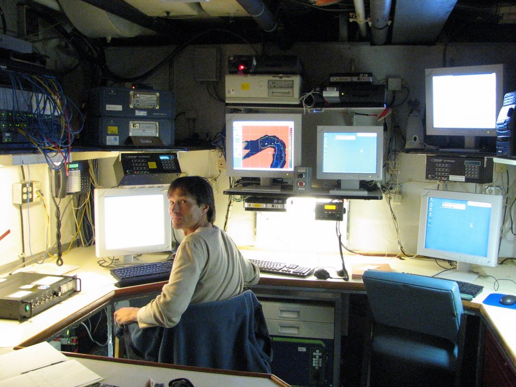
I spent most of the evening working with scientists in the acoustics lab as we headed down our
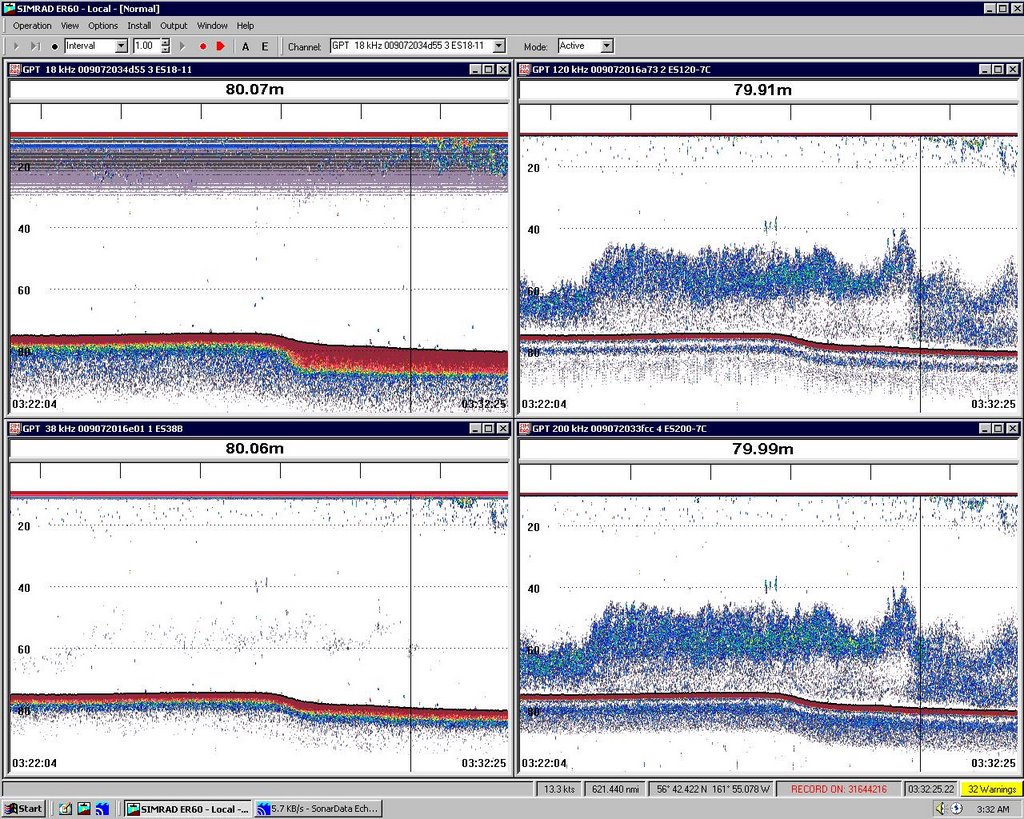 first transact. The sonar is so accurate that you can see all kinds of interesting information. The ship carries a complex sonar. The sound from our sonar is received by 4 different sensors and one for the bridge. Take a look at the picture. The computer screen pictured below shows all four readings on one screen. The orange line at the top of each screen is the top of the water. The larger line at the bottom of the screen is the bottom of the water. Dots in between are usually fish of one kind or another. Each sonar reflects fish differently and by comparing the readings to one another we can get an idea of what is below the ship. The information is recorded at all times, and the data is being analyzed all the time. You can click on the bottom or any of the dots to find its depth. You can also click to compare how the four sensors see each dot. That feature sometimes allows you to tell what kind of marine life you are seeing.
Want to learn more about what the scientists are doing? Click here for a video on sampling.
Question of the Day
Why do you think we need to use an estimate rather than count the exact number of Pollock in the Bering Sea?
Answers from Earlier:
Take a look at the video to see the answer to yesterday’s question.
Answers to Questions
Sorry that the blogger site was giving us trouble for a few hours. Everything seems to be back to normal, though, so pleae keep posting. Here are some answers to questions: We have not had any "luck" sighting fish yet. We will soon, though, and I'll let you know as soon as we bring up our first haul. Snuggy is fine. I have not gotten sea sick at all because the water has been very calm. It is cold here, but the ship is very warm and so I'm just fine.
I don't think that we will find any new species on this trip. To see that, we would have to try to explore environments that are very different from most other places on Earth. Like a volcanic vent beneath the ocean. The Bering Sea has been explored for many years and the species here are well known and documented. They are still very interesting, though.
SCUBA divers can go down to about 100 feet. Sometimes lower. The time they can spend varies depending on how deep you dive (you need more air at lower depths). Figure 20 minutes to an hour. The most common reason for divers to go down on this ship is to work on the equipment below the boat. Because of this, they don't tend to go down very deep and often don't need to stay down very long. The dive I saw lasted about 10 minutes or so.
Many people are asking about the food here. I had a fish sandwich today for lunch, but for the most part, we eat food we get on shore and keep in a large freezer here on the ship. Last night we had chicken and potatoes. It was very good. There is even a lot of fresh fruit, which I love.
My job here will be sorting fish when we bring up the nets. Sometimes they even bring up a shark or two (yes we have them up here!). I'll be careful if I see one. So far I have been observing and helping out the scientists with other jobs while we wait for the first catch. The days have been very full and very interesting. So far I'm not tired. I even find I need less sleep up here where it is light 20 hours or more a day. Sydney, thanks for telling me about the polar bear. That is very interesting, and by the way, though I did go out in a kayak, the water is way too cold to swim without very special equipment and training. Thanks for writing
Photos
The Bering Sea
Glaucous-winged Gull on the bow of NOAA Ship MILLER FREEMAN
Rusty, the ships cat on board NOAA Ship MILLER FREEMAN
Sonar readings from the computers on board NOAA Ship MILLER FREEMAN
Tuesday, June 06, 2006
NOAA Teacher At Sea: Jacob Tanenbaum
NOAA Ship MILLER FREEMAN
Mission: Bering Sea Fisheries Research
Day 6: June 6, 2006
Weather Data from the Bridge:
Visibility: 8 miles
Wind Speed: 7 miles per hour
Sea Wave Height: 2 feet
Water Temperature: 45.32 degrees
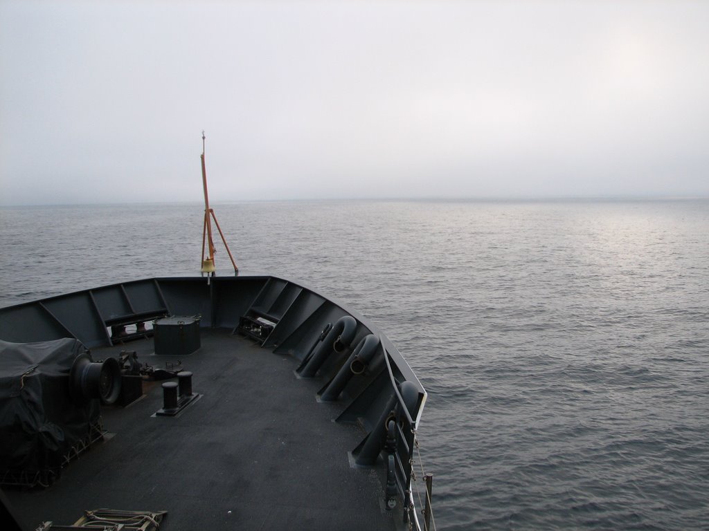
Air Temperature: 48 degrees
Pressure: 1014 Millibars
Personal Log
We reach the Bering Sea. In the last few hours, we went around the tip of the Alaska Peninsula and entered the Bering Sea for the first time. We are now heading north east towards the start of our first “transact,” or research leg where we will begin to study Pollock. The weather has turned much colder. We are all now in sweat shirts, not tee shirts. The heat has come on in our cabins and the sky is grey.
A lot of you have been asking about how the crew keeps safe on this journey. They do this the same way you keep safe at school, by practicing with drills. There are fire drills where we all have to report, or muster, to our fire station areas. They crew take attendance and everyone has a job to do to keep the fire under control.
Of course, out here there are abandon ship drills. When those happen, we report to our life raft
 with our survival gear. Survival gear consists of a suit that will keep you warm, dry and easy to spot while on the water, as well as a life jacket, or personal flotation device. This big orange bulky suit can save your life if you are out in 45 degree water for any length of time. The drills happen every week and keep happening so that everyone on the ship knows exactly what to do and where to go during an emergency. Want to hear what the drill sounds like? Just click here.
Right now, we are all waiting to begin our research while the ship maneuvers through narrow channels in foggy conditions. That means the busiest people on board the ship right now are the ones driving. Want to see how that works? Lets take a trip to the bridge of the ship, where it all happens.
The people in charge of the ship are a group called the NOAA Commissioned Officers. They are a one of 7 uniformed services to the United States just like the Coast Guard or the military. They wear uniforms and hold ranks like ensign, commander or admiral. They are trained to operate the vessel under any conditions. Their training takes place in New York State at a base out on long island. Normally on the bridge, there is an officer of the deck in charge, and a crewman standing watch making sure that there is nothing in our path. Here are some photos of Snuggy the Bear driving the ship and standing watch.
Want to hear more? Lets meet the Captain of NOAA Ship Miller Freeman, Commander Michael Gallagher
JT: How long have you been at sea?
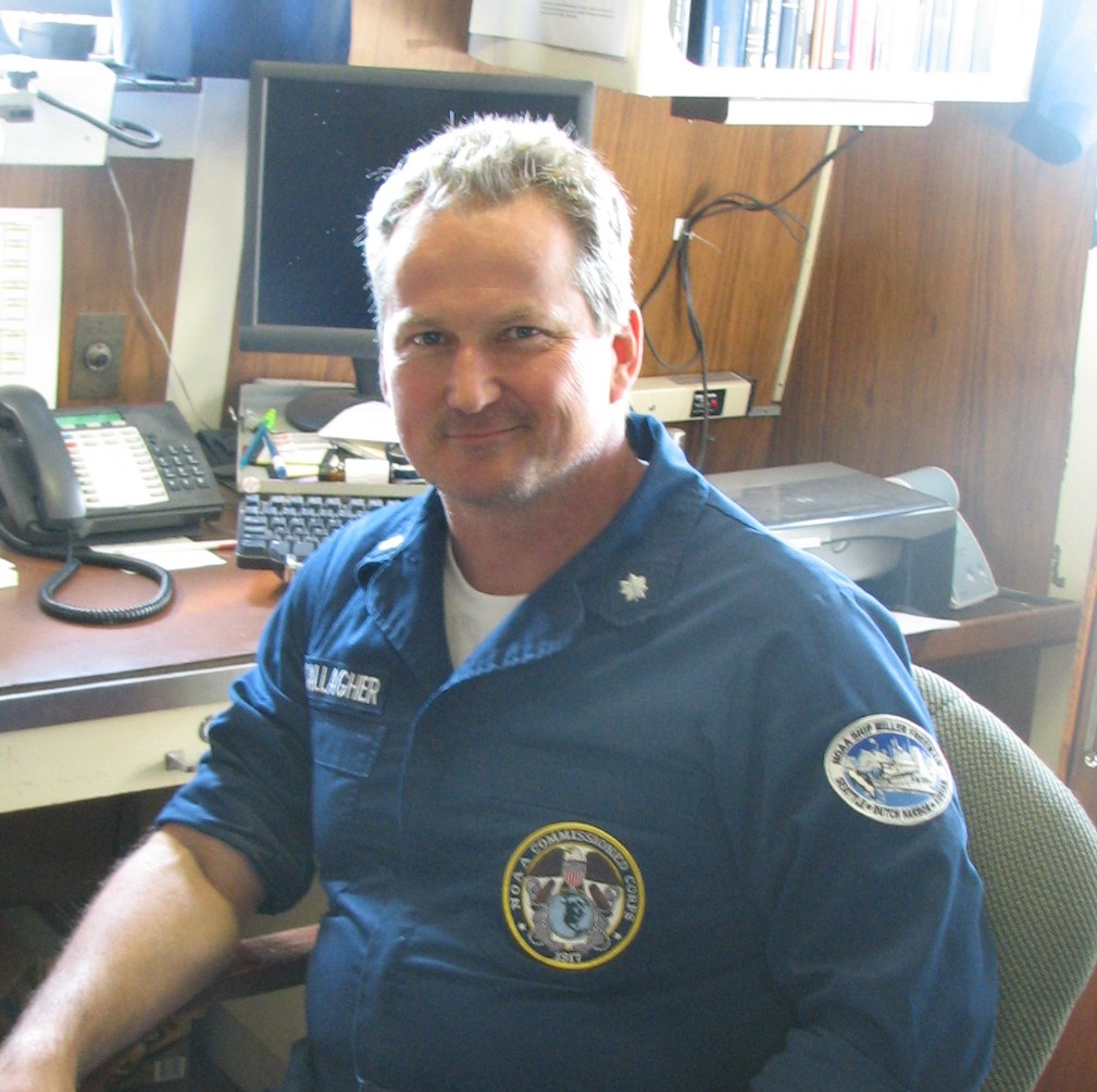
MG: Since I got out of college. 21 and a half years
JT: How did you come to join the NOAA Corps
MG: I got my bachelors degree in chemical engineering. The reason I chose chemical engineering was not because of what chemical engineers did, but because of what they studied. I like chemistry, I liked physics, I liked all the things they studied. In our third year, they started taking us to oil refineries and chemical plants and I realized, I had to get a job and that I didn’t want to work there. I knew that right away. I saw a little tiny card in the job placement office of the college that said, “do you want to fly airplanes into hurricanes? Do you want to sail on an oceanographic research vessel? Do you want to SCUBA dive in coral reefs and I said, that’s what I want to do and that was NOAA Corps.
JT: What is your day like here on the ship?
Click here to listen to Commander Gallagher’s Response
JT: What is the hardest part of you job?
Click here to listen to Commander Gallagher’s Response.
JT: Has your work mainly been in Alaska, or do you go to other parts of the world as well?
MG: My previous sea tours were all in tropical curising. A lot of south pacific, a lot of tropical atalantic. I hadn’t been to Alaska before this ship.
JT: Of all the places that you have visited, which is your favorite and why?
Click here to listen to Commander Gallagher’s Response.
JT: Can you tell us one of your favorite stories of life at sea?
Click here to listen to Commander Gallagher’s Response.
JT: If anyone listening wants to become captain of a NOAA Ship, what would they have to do to prepare?
You need a bachelor’s degree in science, mathematics or engineering. You go into the NOAA core. You do your training and you go in as an ensign and, depending on the size of the ship you have to work at it for 14 to 18 years before you become a captain. We also have some civilian “Masters,” who is a civilian who is in charge of a ship. Three NOAA ships, have civilian Masters. So you don’t have to be in the NOAA corps to be a captain of a NOAA ship. To be a master, you have to get your license and qualifications working in the maritime industry sailing for NOAA or sailing for someone else.
Answers to Questions:
I’ll try to answer as many of your wonderful questions as I can. The volcanoes were all along the Alaska Peninsula and on the Aleutian Islands. So far, there were three that were puffing smoke and all had snow. It does seem strange that you could have both, doesn’t it? None were sending out lava. Just smoke. Perhaps that is why. All the wildlife I have seen, except the eagles, were all from the ship. Sometimes we get close enough to land that we can see bears and goats without leaving the ship. I’m glad I brought along a telephoto lens for my camera and a good pair of binoculars. To spot them, I just stayed near people with experience, like Tamara Mills, the biologist. She knew right where to look. Some of the sailors who have been at sea for a long time also helped me spot wildlife. There is no substitute for experience.
Some of you asked about Kris Mackie’s dive. Yes, he dove in cold water, but the suit he wore kept him from getting wet. He came out of the suit and his clothes under it were still dry! I wish I could dive along with them, but you need special training for this kind of dive and I will not be able to go along. The waves have not been high and so far, I’ve not been sick. A lot of you are asking about the fish we catch, well we start tonight, and I hope we eat some. I’ll let you know. Aren’t the colors of the wildlife amazing? I love the puffins. I have seen some whales jump a little, but not much. And, so far on this boat, the crew has been so great, I’ve not been scared at all. Even when I saw the volcanoes. Snuggy helps as well and is with me in my cabin. He even drives the boat well. It also felt great leaving port with the scientists. It was very exciting.
Oh, and hello to you all. I miss you all. Special hi from the Bering Sea to Simon, Nicky and Zack!
Science Log:
Today we will begin our first transact. In order to count the fish correctly, we will cruise in a kind of a pattern across the water. We will go in a straight line for about 70 miles. This is called a transact. We then move over 23 miles. This is called cross transact. We then go back about 70

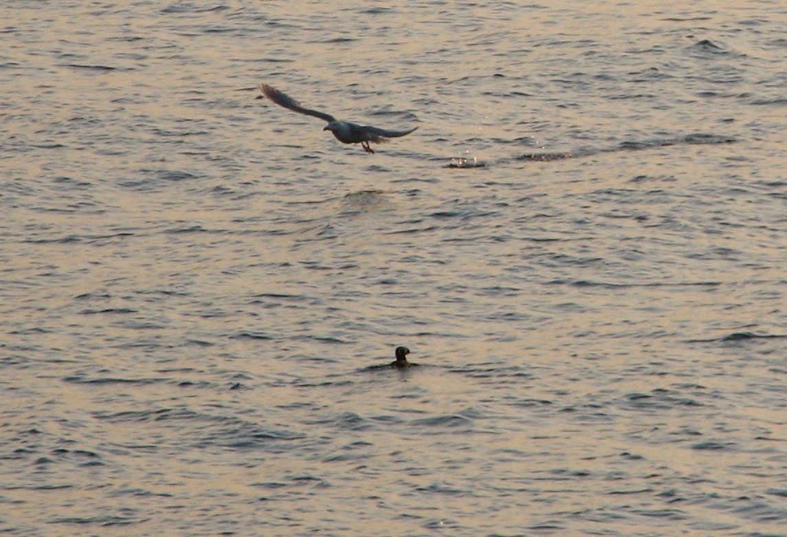
Question of the Day:
Why do you think that the ship goes in this pattern when it studies fish?
Answers from the past Questions of the Day:
The mountain goats from a few days ago live in the mountains in part to avoid predators and in part because there are no other creatures competing for the same food up that high.
Birds from the southern hemisphere are moving north this time of the year because it is now winter in the southern part of the world. Those birds move north the same way that birds from the north move south when it is winter here and it all has to do with food: There is more food to eat where it is summer than where it is winter because more food grows in the warm weather.
Photos:
Sunset over the Alaska Peninsula as we prepare to cross into the Bering Sea
Morning on the Bering Sea
NOAA Teacher at Sea Jacob Tanenbaum in a survival suite on board NOAA Ship Miller Freeman
Snuggy the bear on duty on the bridge of NOAA Ship Miller Freeman
At the wheel
Standing watch
Commander Michael Gallagher, Captain of NOAA Ship Miller Freeman
Transact Path
Tufted Puffin
Tufted Puffin and Gull
Monday, June 05, 2006
Day 5: Bird Count
NOAA Teacher At Sea: Jacob Tanenbaum
NOAA Ship MILLER FREEMAN
Mission: Bering Sea Fisheries Research
Day 5: June 5, 2006
Weather Data from the Bridge:
Visibility: 12 miles
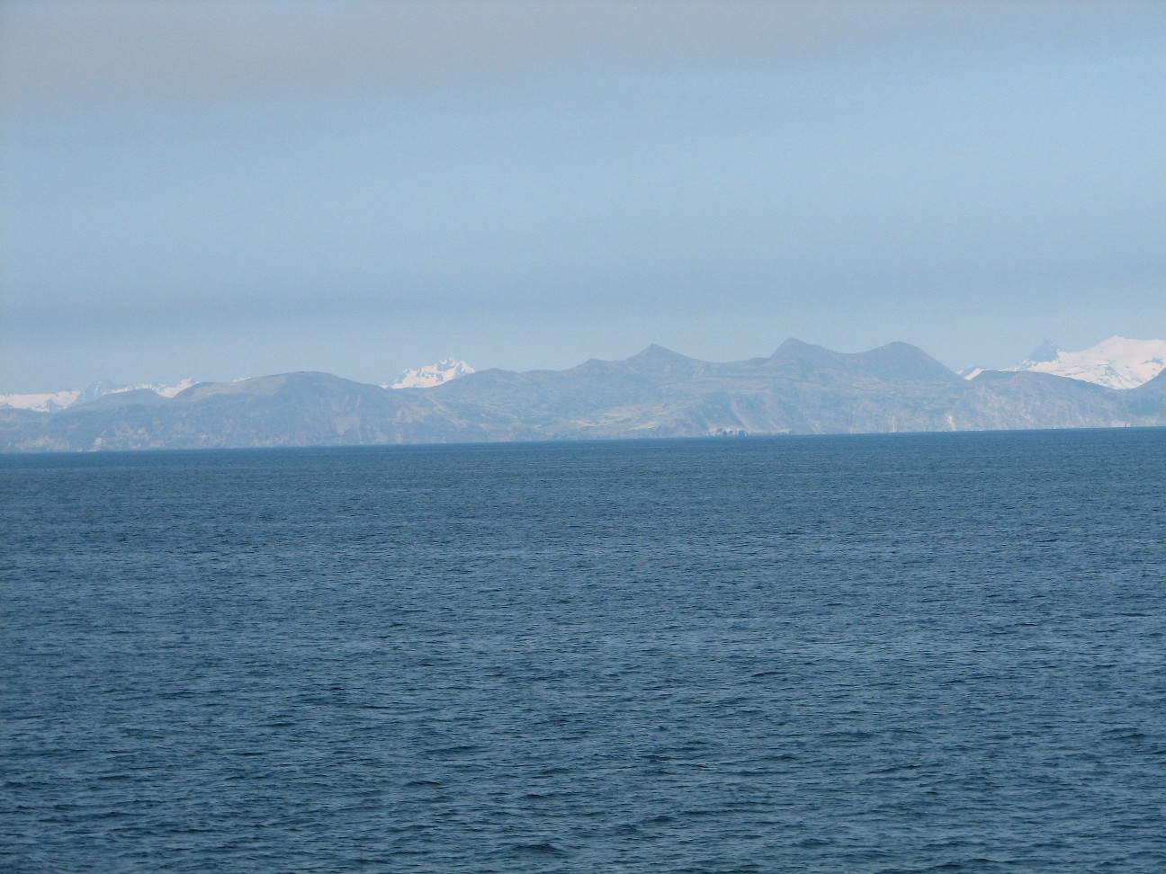
Wind Speed: 7 miles per hour
Sea Wave Height: 2 feet
Water Temperature: 46 degrees
Air Temperature: 49.4 degrees
Pressure: 1017 Millibars
Personal Log
Today we are traveling to where we will do our first study of Pollock. It was a warm day and I spent a lot of it on the bridge looking at wildlife as moved along the coast of the Alaska Peninsula. We even passed and island called Jacob Island. The sea has been calm, and I have not been sick… yet. Click here to see the Alaska Peninsula on Google Earth.
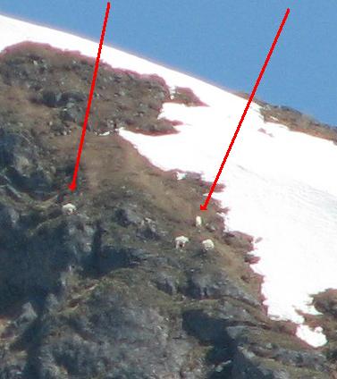 Did you see the goats in the photo yesterday? If you had trouble, here is a close-up showing just the goats. Click on the picture to make it larger. If you scroll down, you can find the photo from yesterday still on this page of the blog. Click to expand it and see if you can find the goats now. Today I have more wildlife to tell you about. I have not seen any fish (yes, there are sharks here) yet because our study has not begun, however we saw lots of birds, some porpoises, and even a whale. We also passed an active volcano! It was sending up smoke while we went by. It was not errupting, but the video I took is still amazing to look at. Click here to see the video. By the way, you can click on each picture to make it bigger.
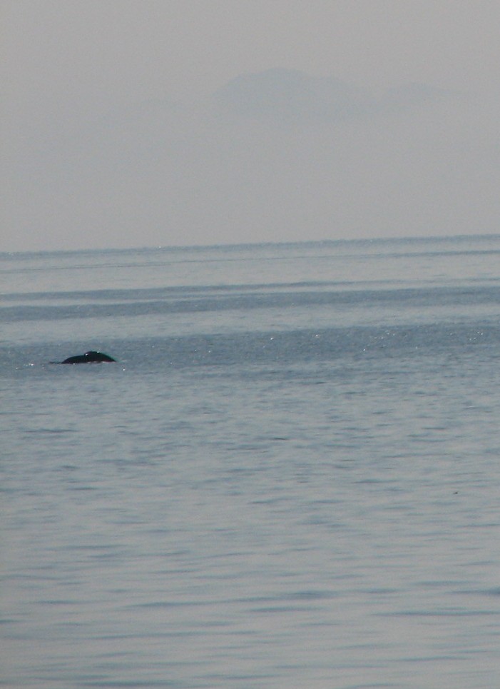
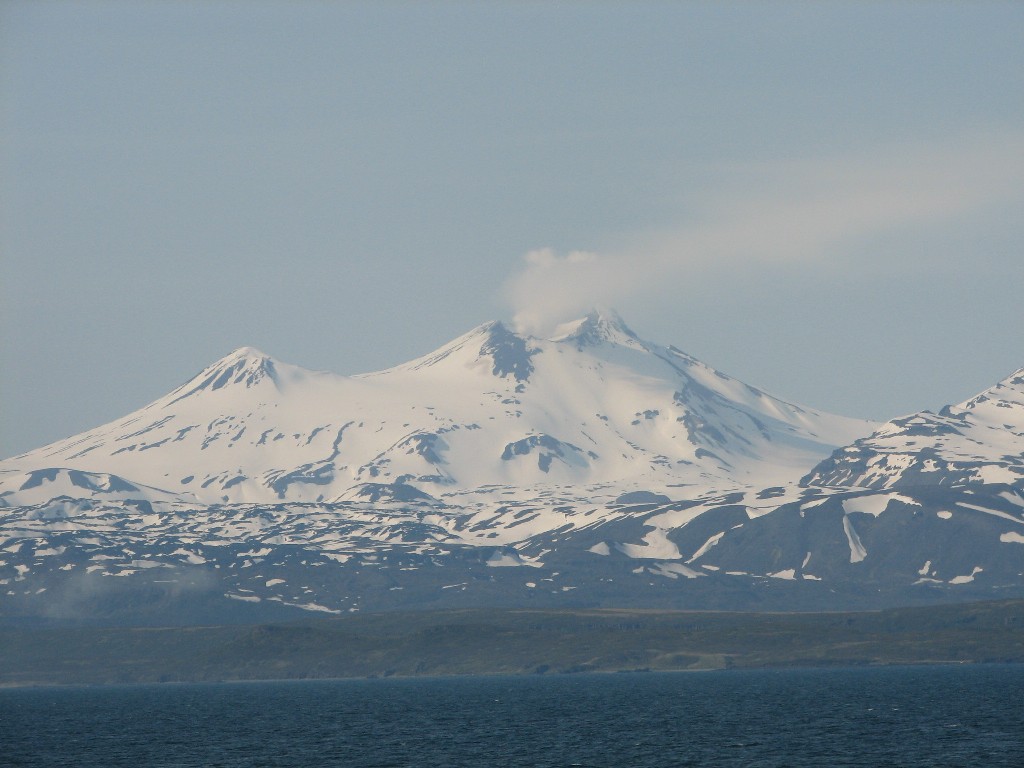
 A lot of you have been asking questions
 about life on the ship. Let me tell you a little about life on NOAA Ship Miller Freemen. I have a small but comfortable room that I share with two scientists. Our room has a bathroom with a shower and sink. Since we all work at different times, usually there is someone sleeping in the room, so you have to be quiet when you go in. The ship also has lots of places to relax, including a library (so of course, there are LOTS of books which I enjoy reading) and an area with a TV and lots of videos. Everything for the TV has to be on DVD or video tape, since there is no cable TV out at sea.. There is also an exercise room for us to use. We have a galley where our wonderful meals are served. Breakfast, lunch and dinner are each only 45 minutes long, so you have to be on time. Last night we had halibut, which is a fish. It was fresh and good. I also had some king crab! We even had pie here, but not blueberry. I do love the food!
I read all your questions. They are wonderful. Here are some more answers for you: Some asked about how long the flight was and how long I will be here. It took 15 hours to get from my house to the ship. Just scroll down and you can read about the entire trip in detail in one of my earlier blogs. I leave the ship in Dutch Harbor, Alaska around the time you get out of school. I have not seen the aurora yet. I will let you know if I do. There are no penguins here in Alaska. They are in the southern hemisphere. But there are some wonderful birds. Have a look below. Some of you also have asked about safety. I will do a blog entry on that tomorrow, so check back, and thanks for writing. By the way, NOAA stands for the National Oceanic and Atmospheric Administration.
Science Log:
Did you know Alaska has 50 million birds? 30 million additional birds arrive here from the
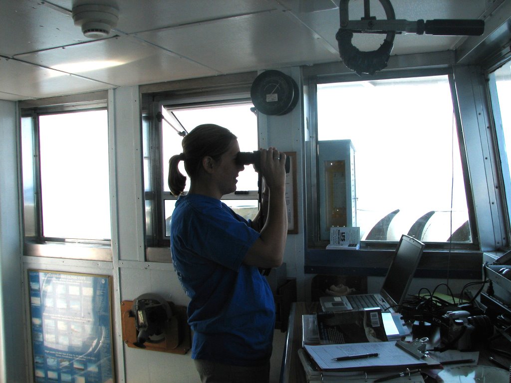 southern hemisphere and spend part of the year here. That is 80 million birds in a state with only 655,000 people. That’s a lot of birds! How do we know this? Today I spent some time with Tamara Mills. She is a biologist from Anchorage Alaska who works for the US Fish and Wildlife Service. She is counting all the sea birds that we see along the trip. She works on the bridge of the ship (where the captain and crew steer). She has a laptop computer and a global positioning system that are hooked together so the computer knows exactly where we are all the time. She enters the number and kind of birds that she sees. She also puts in other information about what the birds are doing. If they are flying, swimming or perched on a rock, she writes that down. Sometimes there are very few birds, and sometimes there are a lot. It can be hard work! How does she keep from counting birds twice? By dividing up the area in front of the ship into blocks. She counts or estimates how many birds there are in each area. Every two and a half minutes, she notes the number of flying birds. This way she does not count those twice. With practice, she can be very accurate.
Click here to listen to an interview with her. She will tell you all about it.
Today while we were on the bridge, we saw tufted puffins, horned puffins, common murres and lots of gulls. Take a look at the pictures below to see for yourself.
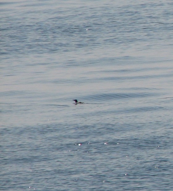
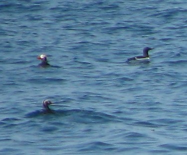
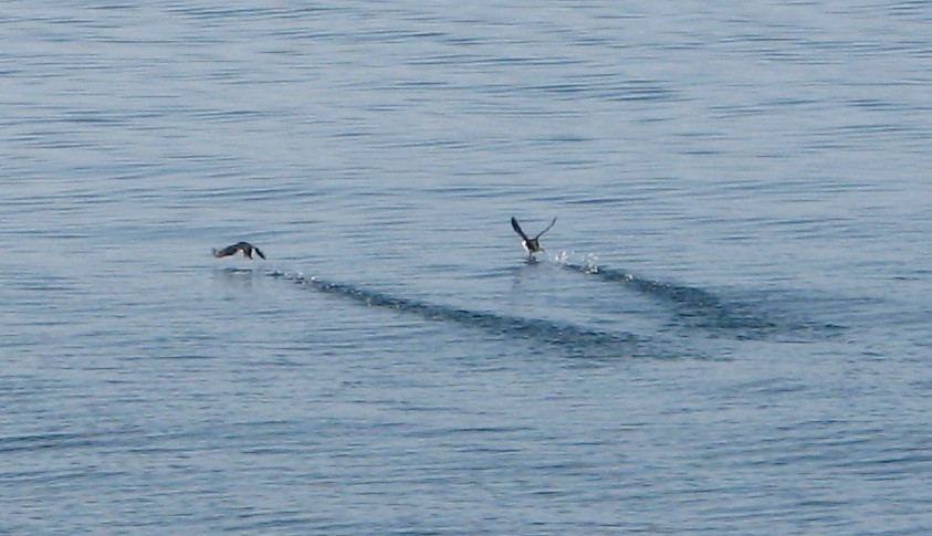


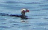
Question of the Day?
Why do you think birds from the southern hemisphere come up north at this time of the year?
Photos:
Jacob Island on the chart
Jacob Island off the starboard beam
The galley and library on NOAA Ship Miller Freeman
Whales off the port beam!
Volcano off the starboard beam!
US Fish and Wildlife Service Biologist Tamara Mills
Bird Photos
- Common murre
- Horned puffin, tufted puffin and common murre
- Common murres in flight
- Tufted puffin
- Tufted puffin
- Tufted puffin
Sunday, June 04, 2006
Day 4: Three Saints Bay, Kodiak Island, Alaska
NOAA Ship MILLER FREEMAN
Mission: Bering Sea Fisheries Research
Day 4: June 4, 2006
Weather Data from the Bridge:
Visibility: 12 miles
Wind Speed: 3.4 miles per hour
Sea Wave Height: 0
Water Temperature: 48.56 degrees
Air Temperature: 73.04
Pressure: 1014.2 Millibars
Personal Log:
I have traveled a fair bit, and have never seen a more beautiful place then Three Sai
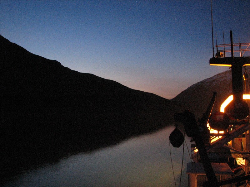 nts Bay. It is a long curved inlet in a remote part of Kodiak Island. There are snow capped mountains on all sides which are filled with mountain goats. Several streams can be seen coming into the bay and one has a water fall several hundred feet high. Yes, in answer to many of your questions, there is a lot of snow. Even though the air is warm during the day. I also see that many of you are interested in what the night is like. Here is a photo. Last night, I stayed on deck for most of the night. There were a few hours of darkness, but part of the sky was still light. This photo shows the darkest the sky became. It only lasted a short time before the sky became lighter again.
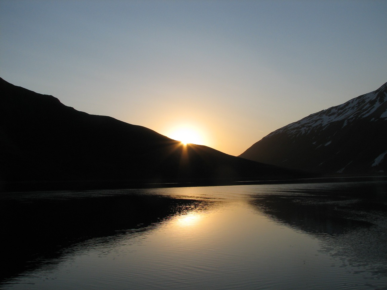
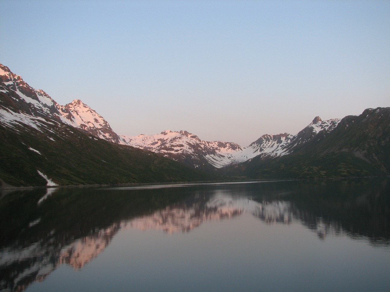
Three Saints Bay is also home to many animals. Because it is so remote, wildlife thrives here. We saw many mountain goats, and we even spotted a bear. I could not get to my camera in time for the bear, but I did take pictures of some mountain goats. Can you find them in this photo? Try clicking the picture with your mouse to enlarge it. Good luck! They are hard to find.
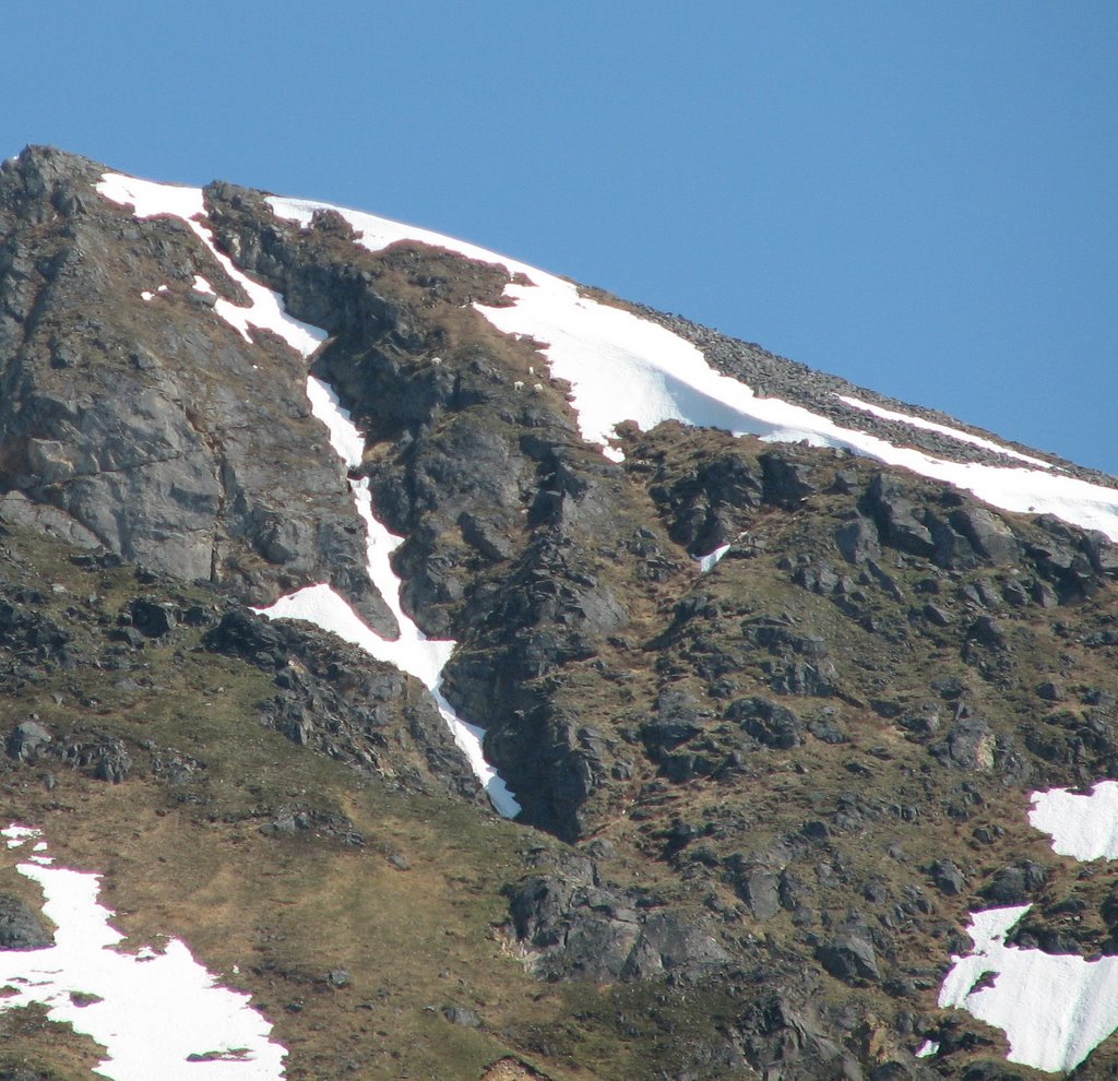
Science Log:
It has been an active 24 hours since we left port. Last night we arrived in Three Saints Bay. A quiet area in a remote part of Kodiak Island. We needed the calm waters to set up our equipment for the survey in the Bering Sea. Our first step is to Calibrate our sonar. A sonar bounces sound waves off of objects in the water, like fish. When the signal comes back, computers display what is in the water below the ship on a screen. A good sonar, like the one we have, can tell where the fish are below the ship. Some bats use a kind of natural son
 ar to “see” insects at night. But first, we have to calibrate the sonar. When you calibrate something, you make sure that it measures exactly right. To do this, we put metal balls below the ship, right under the sonar. Since we already knew the size of the balls, we could make sure the size that the sonar told us was correct. If it was not, we could adjust the sonar. The trick was, getting the metal balls right under the center of the ship. To do this, some scientists and I got on deck around 1 AM this morning (ships like this work 24 hours a day). We stretched a weighted rope across the stern (back) of the ship and then dragged each end up the deck. We had to use long hooks on poles to get it around obstacles all the way to the middle of the ship. After that, we hooked the rope up to 3 small cranes which were controlled by a computer operator in the lab down below. He could move the balls backwards, forwards, left and right using the cranes (aft, forward, port and starboard). Once they were right below the center of the ship, we could make sure the sonar was giving us correct measurements.
The sonar is mounted on the bottom of the ship, and should be checked before each survey to make sure it is working correctly. Since it is mounted to the bottom of the ship, we can not bring it up to look it over. This means divers had to go down into the water in order to check it.
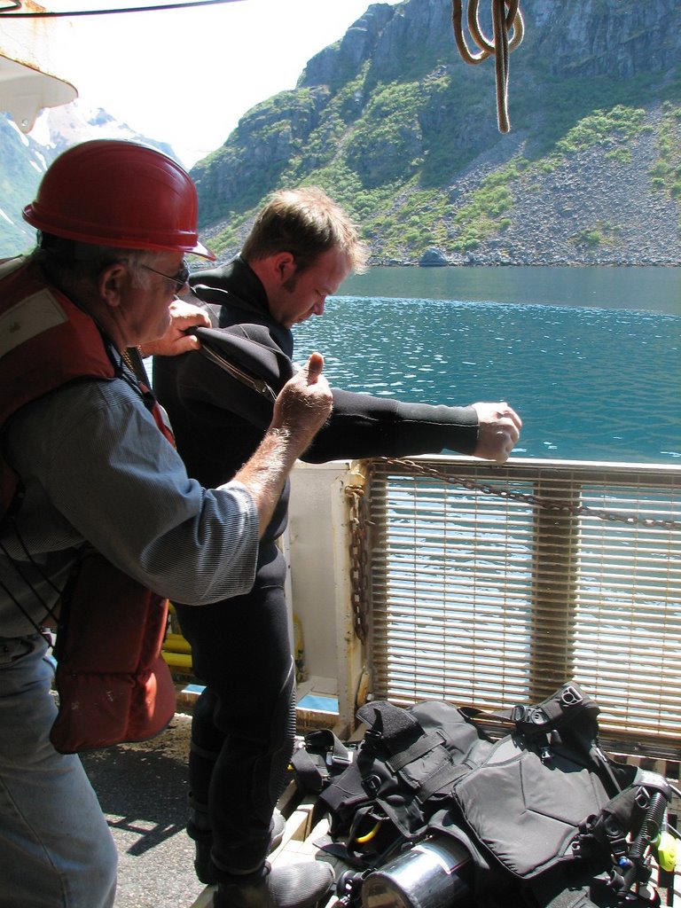 Divers suited up and went below this afternoon. The water was 48 degrees. It would be very unsafe to swim in such water, so the divers suited up in what is called a dry suit. A dry suit is allows you to enter the water without getting your skin wet. The divers also needed to have masks, so they could see, tanks of air so they could breathe, weights, tools and fins to help them swim. They jumped off the side of the ship and went below the center to check and make sure all the bolts on the sonar were secure. After 10 minutes, they emerged on the other side of the ship. They took off their tanks, weights, and other tools and put them in a small launch (little boat) that was in the water to help them. The climbed from there back into the boat, while the gear was passed up to the ship.
It was impressive to watch the true team effort. The divers were assisted at all times by the captain and crew. They were helped into their suit and with their tools. All other work on the ship stops while dive operations are in progress. The operations involved two divers and 5 or 6 crew members who were assisting. CLICK HERE FOR VIDEO and you will see what I mean!!
Lets meet one of the divers
Name: Kris Mackie, Chief boatswain of NOAA Ship MILLER FREEMAN
JT: How did you get to be a NOAA diver?
KM: At the beginning, there were quite a few divers on board, the ship. When they left, I actually got to fill the position. I was reluctant to be a diver at first, I was scared of the idea, but I talked myself into it and went after it. I had never done it before in my life.
JT: What was the training like?
KM: Training was intense. It was three weeks of half-day of textbooks and research and the other half of the day was spent doing multi-dives; 3 or four dives per day. As small as practicing with fins in a pool and progressing up to breathing under the water. It was kind of a kick. Something you have to get past at first. There is a lot of pressure on your chest. Once you get past that it is OK.
JT: How do you like it now?
KM: It is pretty cool. Most of the dives I experience are cold water working dives, I have yet to have the experience of warm water recreational diving. I
have seen a lot of interesting things.
JT: Like what:
KM: What never gets old to me is watching king crab in action on the bottom. It’s pretty entertaining. If you are lucky enough to come across seals, they can get pretty interactive. They come within three or four feet
JT: What was it like below the ship today?
KM: The visibility was phenomenal. Probably 30 feet or so. Very unusual. The sun had a lot to
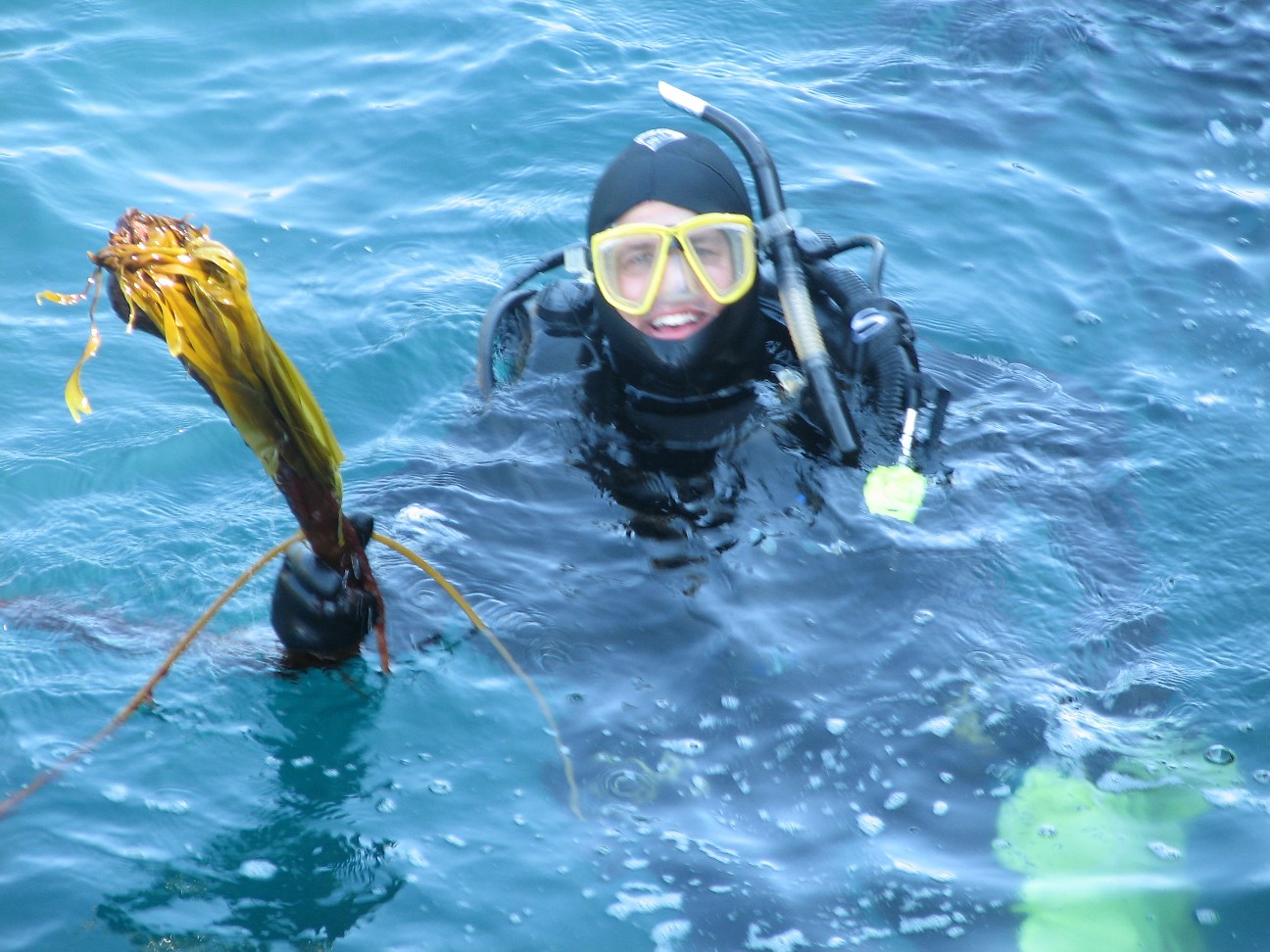 do with that today. I saw a lot of jelly fish, some needle fish. Some other small feeder fish I couldn’t identify. We found kelp wrapped in the screw (ship’s propeller). That was about it. A short dive. If we had gone to the beach we would have been under for 30 minutes or more (the photo shows Kris holding the kelp).
JT: I heard that you dove under the ice pack in the Bering Sea a few weeks ago. What was that like?
Click here to hear Kris describe his dive
JT: What did you do on your dive today?
KM: We were just examining the transducers that the scientists are going to use. Making sure all the screws were there and there were no scratches. We checked the center board and an did an overhaul of the vessel from stem to stern. One thing to do is to make sure the screw is free and clear because it causes noise and backscatter which interferes with the sonar.
JT: What does it take to be a NOAA Diver:
KM: One year of sea time on board ship and you have to be able to swim.
Question of the day:
How would living high in the mountains help these goats to survive?
Photos:
Night on the deck of NOAA Ship MILLER FREEMAN
Three Saints Bay at Sunrise (2 photos)
Mountain Goats in Three Saints Bay, Kodiak Island, Alaska
Michael Guttormsen works in Acoustics Lab on board NOAA Ship MILLER FREEMAN
NOAA Diver Kris Mackie is assisted into his equipment by Scott Harrington on board NOAA Ship MILLER FREEMAN
NOAA Diver Kris Mackie holds kelp he found in the propeller of NOAA Ship MILLER FREEMAN
Saturday, June 03, 2006
Day 3: We Go To Sea!!
NOAA Ship MILLER FREEMAN
Mission: Bering Sea Fisheries Research
Day 3: June 3, 2006
Weather Data from the Bridge:
Visibility: 12 miles
Wind Speed: 11 miles per hour
Sea Wave Height: 2 feet
Water Temperature: 49 degrees
Air Temperature: 53 degrees
Pressure: 1013 millibars
Personal Log:
I spent most of the morning kayaking in beautiful Kodiak, Alaska and spent the afternoon getting ready to leave port. It was a day for birds today. I saw gulls, arctic terns, puffins, eagles, cormorants, and
The ship left Kodiak at 3:00 PM bound for Three Saints Bay to begin our work. It was exciting to watch the ropes finally get pulled in and to watch the ship pull out of the port we have been in for the last two days.
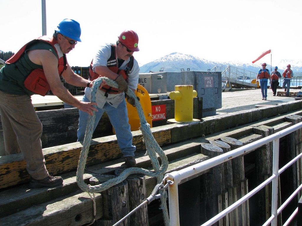
First the announcement came over the loud speaker asking all visitors to leave the ship. Just about that time, the engines started up. Next came a scurry of activity as attendance was taken to make sure everyone was aboard. A crew arrived on the dock and began to assist us as we pulled out. Hard hats and life jackets were the rule of the day on deck as cranes lifted the gang plank off the ship and on to the dock. Finally the crew on the dock took the ropes and threw them over to our deck hands and we were free of the mooring for the first time. The bridge officers ordered the engines up and we slowly moved away from the dock. Click here to listen for yourself.
So far the trip has gone very well. We have had some small waves, and I am not feeling sick at
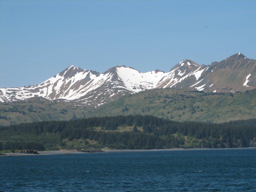 all. I have some bracelets that are supposed to help with motion sickness, and so far they are working very well. The view of Kodiak Island is amazing.
Let me answer some of your questions:
 Snuggy is doing very well. He is safe and warm in my cabin downstairs on the ship. Today he came out to look around as we left Kodiak. Take a look at what he saw. My shipmates are all very nice people. I have met several friends and I am going to introduce them to you later in the voyage by interviewing them and telling you all about what they do on the ship. The weather has been warm. I am in short sleeves. In part, because the engines on the boat are warm.
Science Log:
Today we are on route to a bay called Three Saints Bay, where we will stop and set up the sonar so we can begin work. I will tell you more about that tomorrow as we do the work.
Photos:
The ropes of the NOAA Ship MILLER FREEMAN are untied from the dock.
Teacher At Sea Jacob Tanenbaum on deck of the NOAA Ship MILLER FREEMAN as we leave port.
Kodiak Alaska seen from the deck of the NOAA Ship MILLER FREEMAN
Snuggy The Bear on the bow of the NOAA Ship MILLER FREEMAN
Friday, June 02, 2006
Day 2: In Port Getting Ready
NOAA Teacher At Sea: Jacob Tanenbaum
NOAA Ship MILLER FREEMAN
Mission: Bering Sea Fisheries Research
Day 2: June 2, 2006
The ship is at port in Kodiak, Alaska preparing to embark.
Personal Log
Snuggy and I are exploring Kodiak, Alaska. For those of you who have not met him, Snuggy is a stuffed polar bear who is along for the ride here. Mrs. Carmondy's Class came up with the idea. In answer to your questions, I had no trouble sleeping last night. Probably because I was so tired from the trip. I have a bunk in a room with two scientists from Russia. They are nice roommates and have been interesting to talk to during the trip. The food has been great so far. No sea food yet, but lots of good meals cooked by the staff on the ship. Since we are still at port, I have not been sea sick yet, but I will let you know.
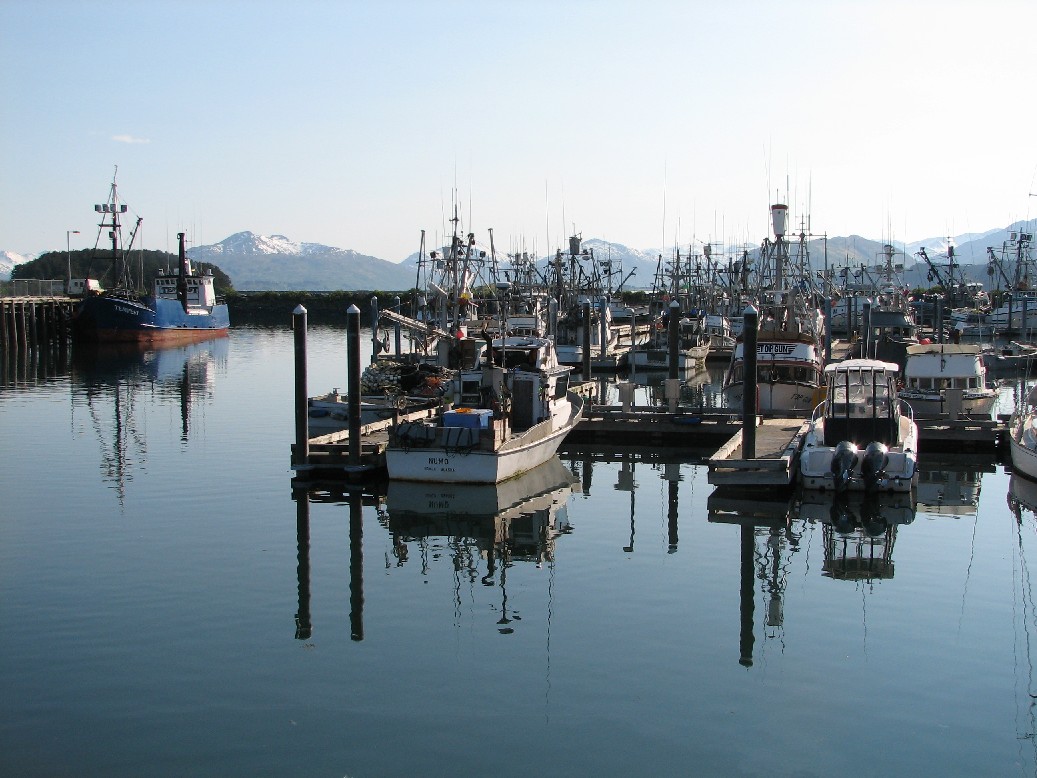 I spent the day in and around Kodiak, Alaska. One of the most beautiful places I have ever seen. It has also been interesting to speak to many people around the town. Kodiak, like much of Alaska, does not have many people. Some people live in town, and some are spread around the island. That makes some of the schools different from those we know at home. In this part of Alaska, if there are more than 10 children in an area, even a remote one, the state sends in a teacher and they create a small school. Some are even one room schools where all grades are in the same room and have the same teacher. Kodiak has one in a logging camp in one part of the island. In some cases, especially for older students, they may have to take some subjects via the internet using distance learning. Like the connection from the ship, internet here is often by satellite.
Please remember not to use last names in the blog. I read all your blogs, but cannot publish them to the site if they contain last names.
Science Log
Today was all about getting ready to go. Samples from the last cruise were on there way out and new equipment was on its way in. Scientific teams are arriving all the time and the new crew is being shown around.
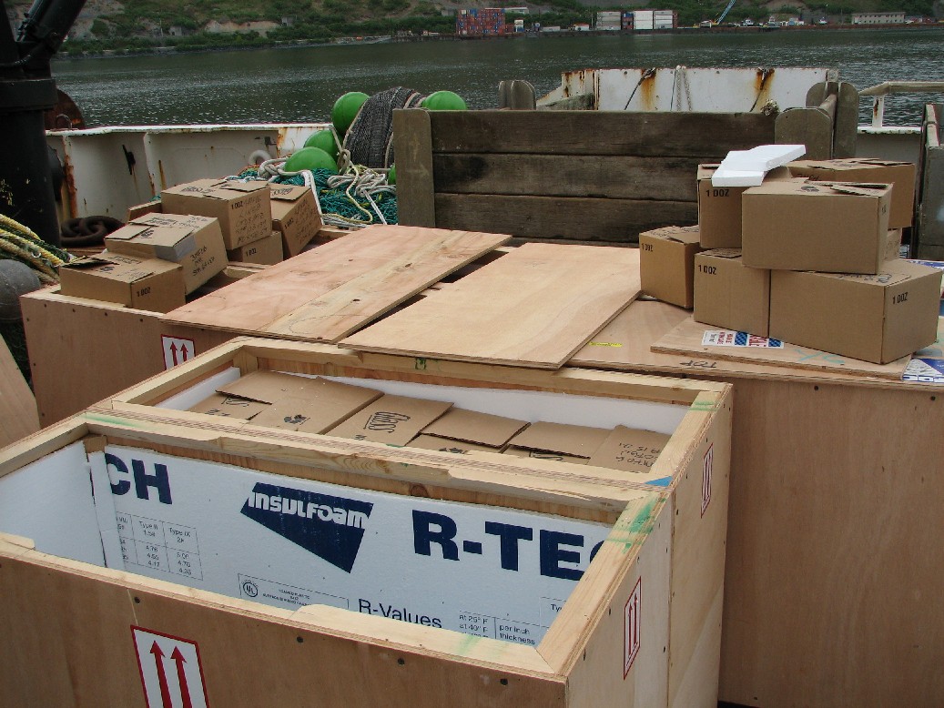
Photos:
TOP: Snuggy the bear in his "rack" on board the NOAA Ship MILLER FREEMAN
LEFT: Samples from the last cruise on route to Seattle
Right: incoming equipment still in its crates waiting to be unloaded.
Thursday, June 01, 2006
Greetings From Alaska -- June 1
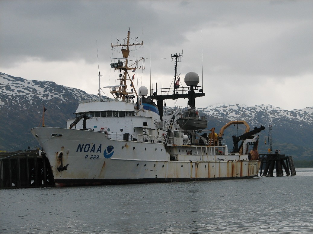 NOAA Teacher At Sea: Jacob Tanenbaum
NOAA Ship MILLER FREEMAN
Mission: Bering Sea Fisheries Research
Day 1: June 1, 2006
The ship is at port in Kodiak, Alaska preparing to embark.
Personal Log:
Greetings from Alaska. What a journey!! I started from home at 5:30 this morning on route to Newark Airport in New Jersey. From there, I flew to Seattle Washington. In Seattle, I had to change plan
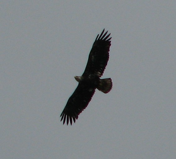 es and fly to Anchorage Alaska. From there, I boarded a small jet to go to Kodiak Island, off the southern coast of Alaska on the Gulf of Alaska. We rode in a small jet that was half full of cargo and half full of people. I arrived at the dock excited and exhausted 13 hours after I began. Kodiak is amazing. It is the second largest Island in the USA. There are 3000 bears (but snuggy is the only polar bear here). I saw a bald eagle circling the dock as I went walking after dinner. Take a look at the photos. Can you see all the snow here! A lot of people are asking if it is difficult to sleep in daylight. I will let you know how the first night goes, but right now I'm so tired, I don't think I'll have any trouble at all. Click here to see Kodiak Island using Google Earth (you must have Google Earth on your computer for this to work).
Snuggy is fine as well. He is keeping me company on the voyage.
Science and Technology Log:
Teams of scientists are arriving and equipment is being loaded on to the boat all the time. We will be ready to leave Kodiak on Saturday and begin our work.
Photos:
The NOAA Ship MILLER FREEMAN at port
A bald eagle circles the ship
Question of the Day:
What is the Midnight Sun? Take a look at the links on this website and see if you can explain it.


